Cincinnati Historical Maps
Item set
- Title
- Cincinnati Historical Maps
Items
-
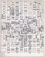 Published by the Cincinnati Convention Committee, this brochure introduces visitors and residents alike to buildings in the city. The street map of the downtown business district and part of Over-the-Rhine highlights the building described in the brochure. From the book: The New Cincinnati -Are You Acquainted with it? Rare Books: Oversize F499.C5 N385 1932
 -
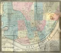 This map is separated into wards and street names are labeled. Although no reference key is provided, some buildings and areas are marked, such as "Garden of Eden" Park. Looks like we finally found it! Portions of Covington and Newport are also shown with labeled streets. This is comes from the book The Queen City in 1869 by George E. Stevens, Rare Books Call Number: F499.C5 S8
 -
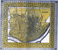 This map reflects the first efforts of expansion through annexation, including the areas north of Liberty Street - Mt. Auburn, Walnut Hills and part of today's Over-the-Rhine. The map is separated by wards, which are numbered. From Williams' Cincinnati Directory, City Guide and Business Mirror or Cincinnati in 1855 Rare Books F499.C5 A18 1855
 -
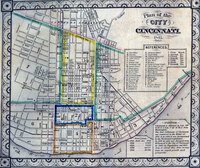 Cist's map is separated into wards that would help readers locate the proper section of the directory to consult. Population numbers are given from 1805-1840 and a brief statement about the founding and development of the city is provided. The reference key lists public buildings, businesses, and social organizations. From the book, The Cincinnati Directory for the Year 1842 compiled by Charles Cist Rare Books Call Number: F499.C5 A16 1842
 -
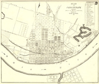 This map shows Cincinnati as it was incorporated as a city in 1819. A reference key points to significant buildings and landmarks. Note land dedicated to the newly established Cincinnati College just to the right of the eastern section line. Small parts of Newport and Covington are included, but not labeled. From the book: Centennial History of Cincinnati by Charles Greve (1904) Rare Books Call Number: F499.C5 G74
 -
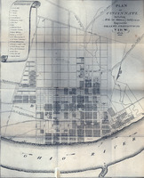 This map was specially engraved for Drake's book. A reference key points to significant buildings and landmarks, including public buildings, churches, businesses, and of course breweries. Streets are labeled and boundaries are noted. From the book: Natural and Statistical View, or Picture of Cincinnati and the Miami Country by Daniel Drake Rare Books Call Number: F499.C5 D82
 -
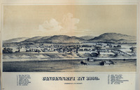 This early drawing shows the settlement of Cincinnati on the banks of the Ohio River. Fort Washington can be seen at the rear on the right side and the homes of prominent citizens are labeled. From the book: The Queen City in 1869 by George E. Stevens Rare Books Call Number: F499.C5 S8
 -
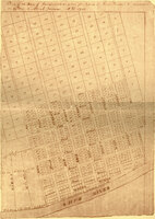 This is an enlarged facsimile of Robert Clarke's reproduction of original records maintained by Cincinnati settler Israel Ludlow. Included is Ludlow's plan of the town of Cincinnati for 1802. The plan is accompanied by a list of the settlers to whom each lot was sold in 1789. The land that would become Cincinnati was purchased in 1788 by Matthias Denman from John Cleves Symmes and was named "Losantiville." General Arthur St. Clair renamed the town "Cincinnati" in 1790. This image is taken from the following book: Record of the distribution and sale of lots in the town of Losantiville (now Cincinnati) 1789 by Robert Clarke Rare Books Call Number: F499.C5 R411957