Cincinnati Map
Item
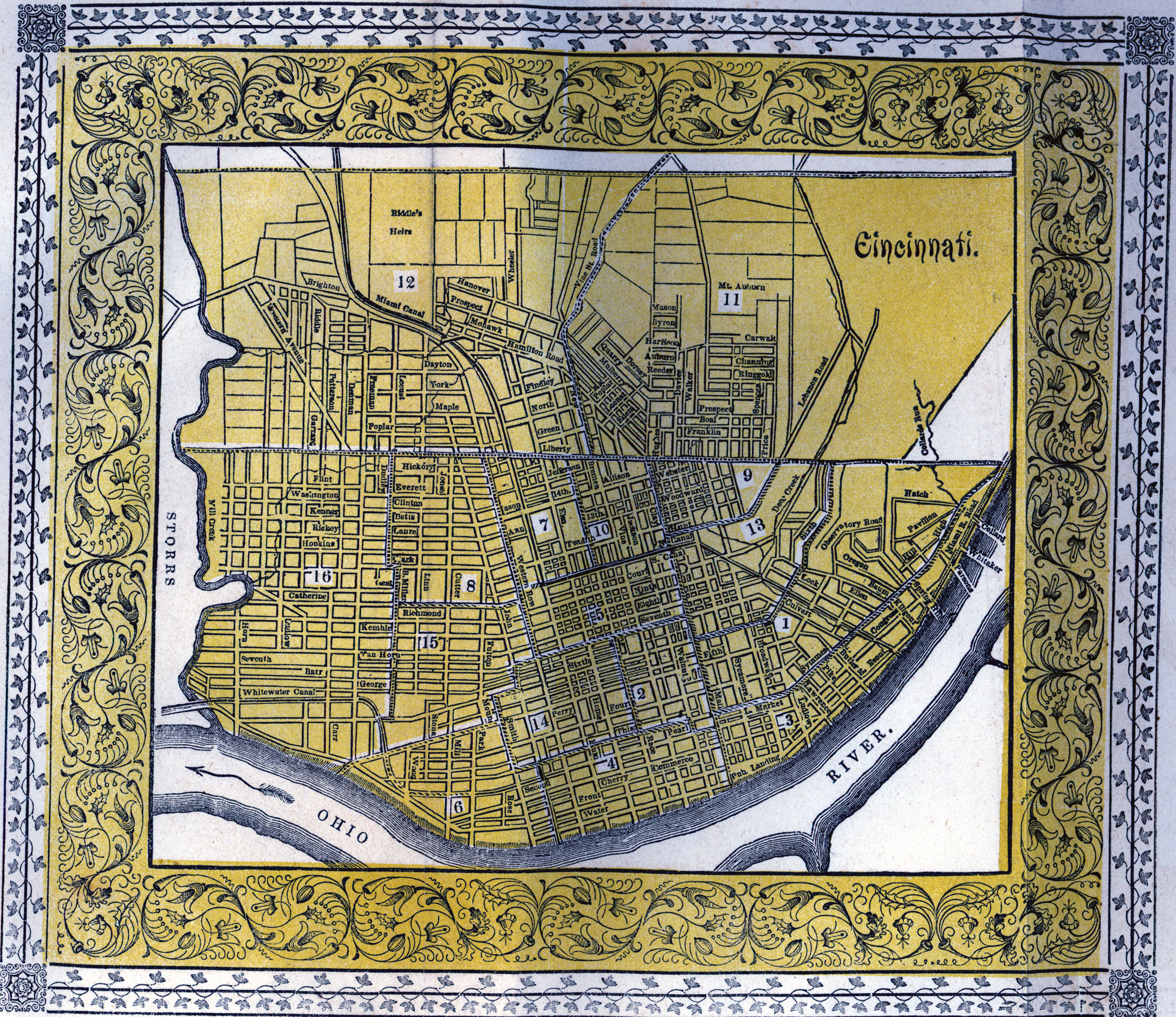
- Title
- Cincinnati Map
- Creator
- Williams' Cincinnati Directory
- Date
- 1855
- Description
-
This map reflects the first efforts of expansion through annexation, including the areas north of Liberty Street - Mt. Auburn, Walnut Hills and part of today's Over-the-Rhine. The map is separated by wards, which are numbered.
From Williams' Cincinnati Directory, City Guide and Business Mirror or Cincinnati in 1855
Rare Books F499.C5 A18 1855
- Item sets
- Cincinnati Historical Maps
- Site pages
- Historical Maps of the City of Cincinnati
- Media
 Map of Cincinnati 1855
Position: 7 (565 views)