
By Angela Vanderbilt
The primary task of the Rapid Transit Commission and the 1917 Bauer Bill (Senate Bill 264, which authorized the formation of a commission for the design and construction of a rapid transit system) was not the construction of the subway alone, but the construction of Central Parkway, the “grand boulevard” that was to replace the Miami & Erie Canal. The Commission was also tasked with the secondary subway project to ensure that the Parkway was built, since the one could not commence before the other was underway, a means of ensuring the success of both.
When it was first proposed in a 1907 report, written by landscape architect George Kessler regarding the development of a city park system for Cincinnati, Central Parkway was meant to rival Boston’s Commonwealth Avenue and the grand boulevards of Europe, to be landscaped and lined by stately brownstones and mansions. Accented by decorative lampposts, fountains, trees and shrubbery, the new boulevard was to provide a park-like atmosphere for Cincinnatians, with sidewalks to stroll and benches on which to relax and enjoy the scenery of the Parkway as it wound its way north from Walnut Street in the downtown business district to Lundlow Avenue in the residential neighborhood of Clifton.
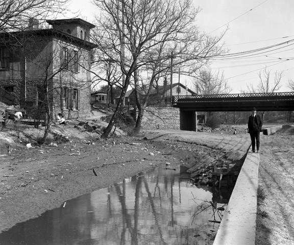
Ludlow Avenue Dam, May 4, 1920
The Parkway and the tunnel section of the subway would share a portion of the same route, beginning just east of Walnut Street at the Reading Road and Eggleston Avenue split – the site of the new Hollywood Casino—running west past Main and Vine Streets, continuing on past Race and Elm Streets to the Plum Street curve, where it would head north past Liberty Street and Mohawk Place, then under Brighton Bridge and past Marshall Avenue and Hopple Street to Ludlow Avenue. At this point, Central Parkway would terminate, while the subway being built beneath it would exit the old canal’s path and emerge on open track continuing its circuitous route east through St. Bernard and Norwood and on toward Oakley.
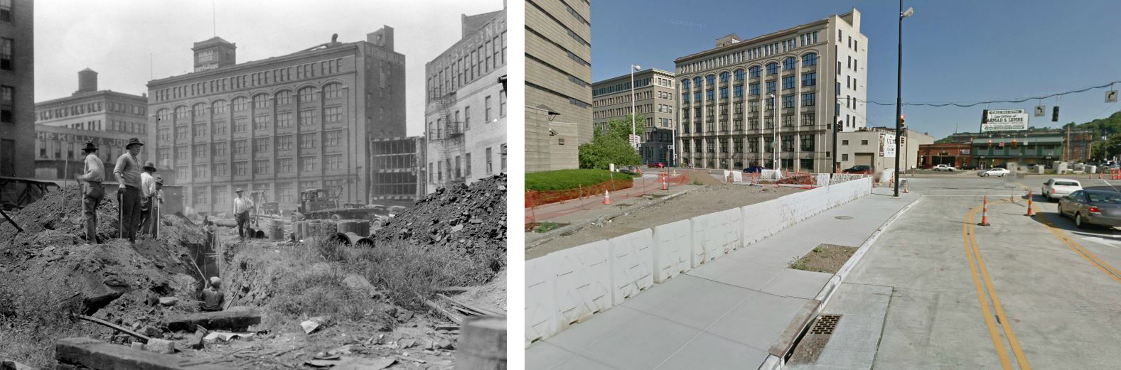
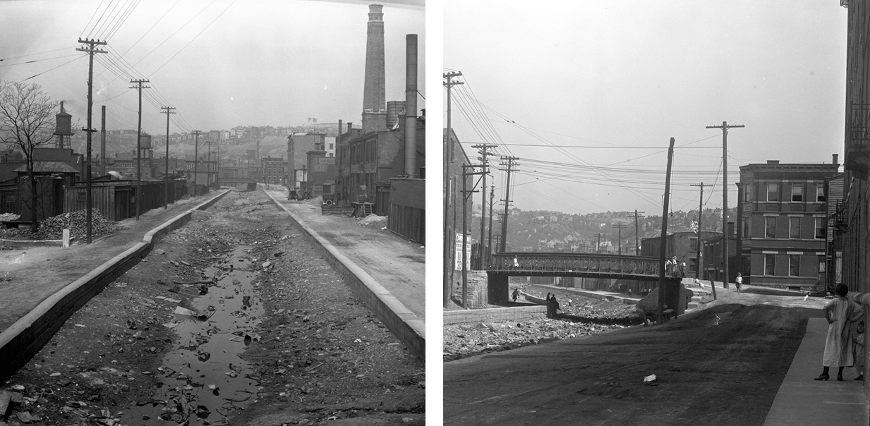
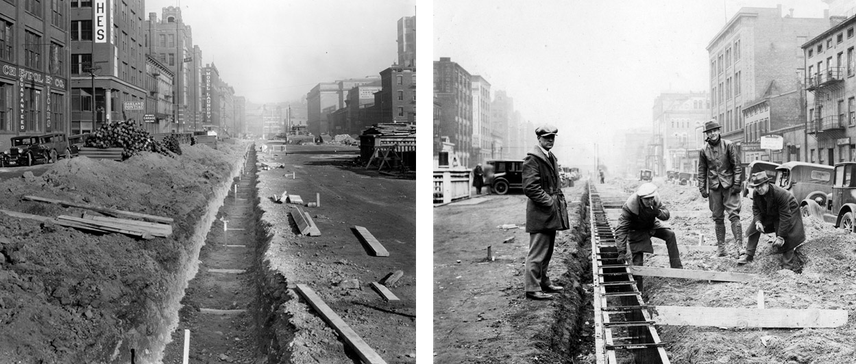
LEFT: Construction of sewer trench beneath Central Parkway, looking north from Court Street, August 10, 1926; RIGHT: View during construction of Hollywood Casino via Google Maps
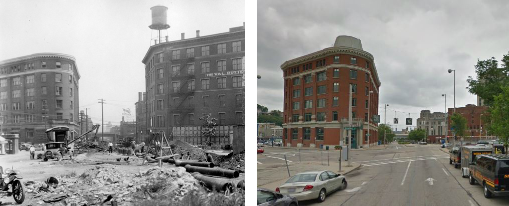
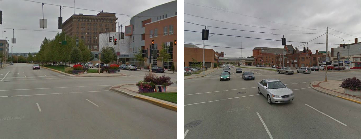
LEFT: View down South branch of “Y” from Central Parkway, August 10, 1926; RIGHT: View during construction of Hollywood Casino via Google Maps
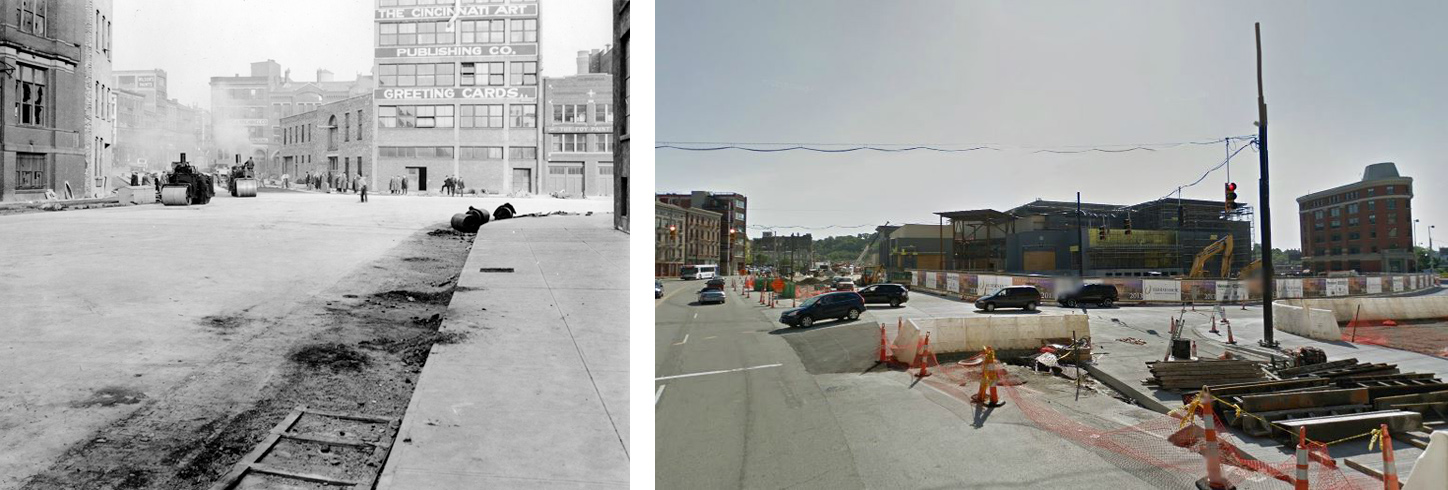
LEFT: Laying asphalt on north branch of Central Parkway “Y”, December 3, 1926; RIGHT: View during construction of Hollywood Casino via Google Maps
But before Central Parkway could be constructed, the subway tunnels had to be built. And before the tunnels could be built, the canal had to be drained. And once drained, workers faced the daunting task of clearing the debris that was exposed. Since 1845, the Miami & Erie Canal had served not only as a means of commercial transportation through Cincinnati to the Ohio River, but also as an impromptu landfill. When drained, the canal revealed an assortment of trash that had been discarded into the stagnant, murky water by residents who assumed it would either float away or sink and never be seen again. Once the debris was cleared, and the subway tunnels were completed, the Parkway construction could begin. This was just one of many unexpected hurdles that would delay the construction of both the subway and Central Parkway on its path to incompletion.
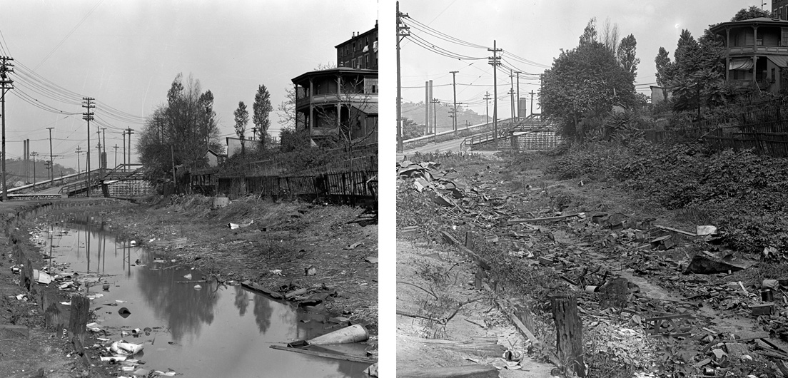
As the Miami & Erie Canal was drained, decades of debris hidden beneath the water was slowly revealed. LEFT: The canal bed at the Crosstown Bridge (Brighton Bridge) begins to reveal its contents. May 5, 1921. RIGHT: An assortment of debris, including tin cans, wooden boxes, broken furniture, and wire fencing, is visible. June 17, 1921.
LEFT: The view north from the Liberty Street Bridge shows similar debris at the bottom of the canal. April 22, 1920. RIGHT: In front of Proctor’s Flats at the Findlay Street Bridge, children play in the empty canal, picking through the rubbish for scraps. June 18, 1920.
In 1926, the majority of commuters were expected to utilize the subway for their transportation needs. Conversely, the landscaped Parkway was expected to provide a scenic route for touring motorists travelling through the Over the Rhine district and other neighborhoods bordering the route into the downtown business district. In the downtown area, it would provide a park-like setting for residents living in the grand brownstones to be built, as well as for shoppers and businessmen wanting to relax and take a break from the hustle and bustle of the city’s pace.
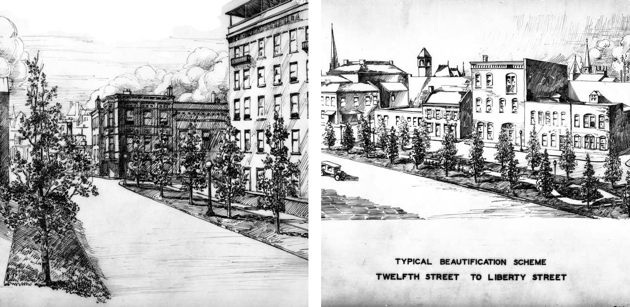
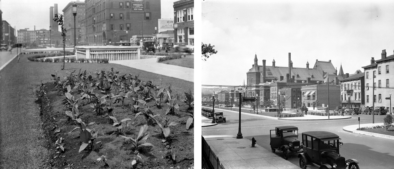
Artist renditions for Central Parkway Beautification Scheme, January 10, 1926, LEFT: Findlay Street to Mohawk Street; RIGHT: 12th Street to Liberty Street
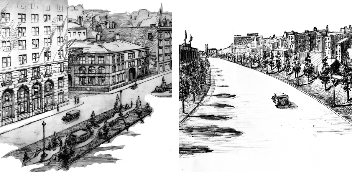
LEFT: View looking east toward Elm Street, YMCA building in foreground on left; RIGHT: Mohawk Street to Brighton Bridge
By 1924, no construction had started on the Parkway. Delays encountered during subway construction shifted focus, and funds, to the secondary project. The Commission requested the City Engineer to begin drawing up plans for the Parkway in 1921, when Sections 1, 2, and 3 were nearly complete. Due to the Parkway being laid out over the former canal’s right of way, surveying and excavation were required to ensure a consistent width and grade of the road surface, which was previously raised in areas where bridges crossed over the canal, or lower in areas where streets ended at the canal. Entrances to homes and businesses along the Parkway’s route needed to be adjusted based on the new grading.
LEFT: Excavation to prepare footer for median wall on Central Parkway, looking east from Vine Street, Nov. 12, 1926. RIGHT: “Engineers at work Central Parkway and Race St. Zero weather!!” December 2, 1926
Completed Central Parkway TOP LEFT: Looking west along Central Parkway from Race Street (YMCA in background, subway ventilation shaft in center tulip bed in foreground), July 2, 1928. BOTTOM LEFT: View today via Google Maps. TOP RIGHT: Looking north along Central Parkway from 12th Street (Music Hall in background) July 6, 1928. BOTTOM RIGHT: View today via Google Maps.
Central Parkway was completed and opened to the public in October, 1928. Unfortunately, with the failure to complete the subway and the later construction of the Millcreek Expressway parallel to the Parkway (and ultimately the construction of I-75 which severely limited accessibility to the area), the importance of the Parkway as a front for major civic and commercial buildings was lost to the riverfront. Residential development did not occur as expected, either. Very few buildings have been constructed along the Parkway over the past decades, with the exception of the Kroger Company headquarters and the School for Creative and Performing Arts among the few. Restoration and adapted reuse of some buildings contemporary with the Parkway’s construction has seen a rise, but mainly as residential centers consisting of small studio apartments and condominiums. Central Parkway, especially the section north of the Plum Street elbow, has endured a roller coaster ride of economic and civic hardships and recoveries, but with no significant upswing on the horizon.
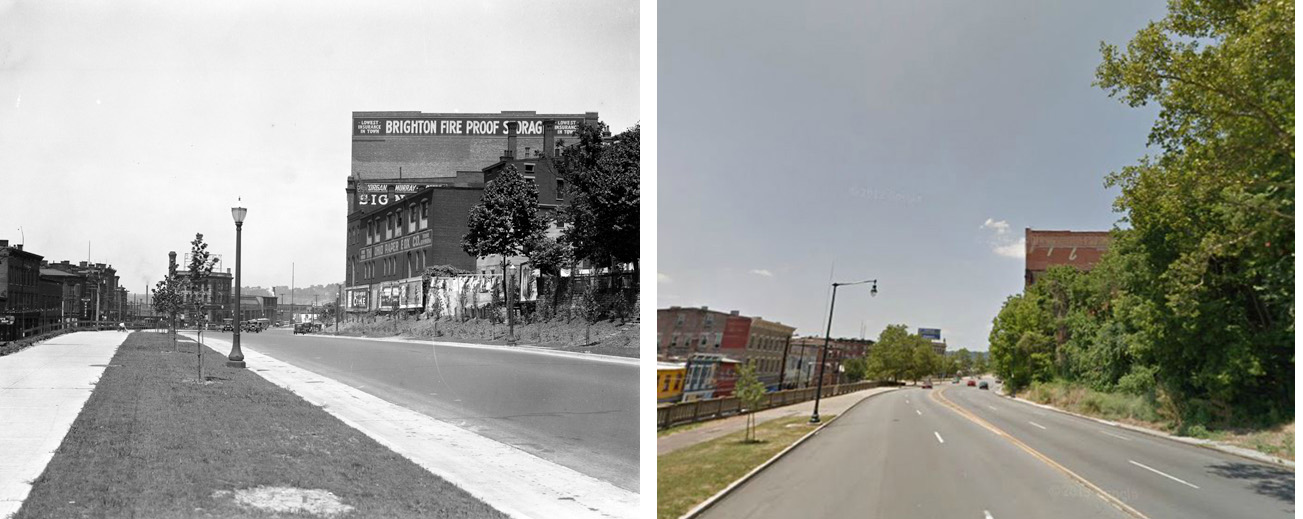
LEFT: View looking north along Central Parkway toward Brighton Bridge, July 11, 1928. RIGHT: View today via Google Maps
 This project is funded by a grant for $60,669 through the Library Services and Technology Act, administered by the State Library of Ohio.