I joined Research and Data Services (R&DS) in August 2019 as a Graduate Assistant (GA). R&DS is composed of multiple research and consultation labs across campus including the Data & GIS Collab, which is located inside the GMP Library (Braunstein 240). The Collab is designed to provide research and teaching consultations on the use of geocomputational software such as ArcGIS and QGIS.
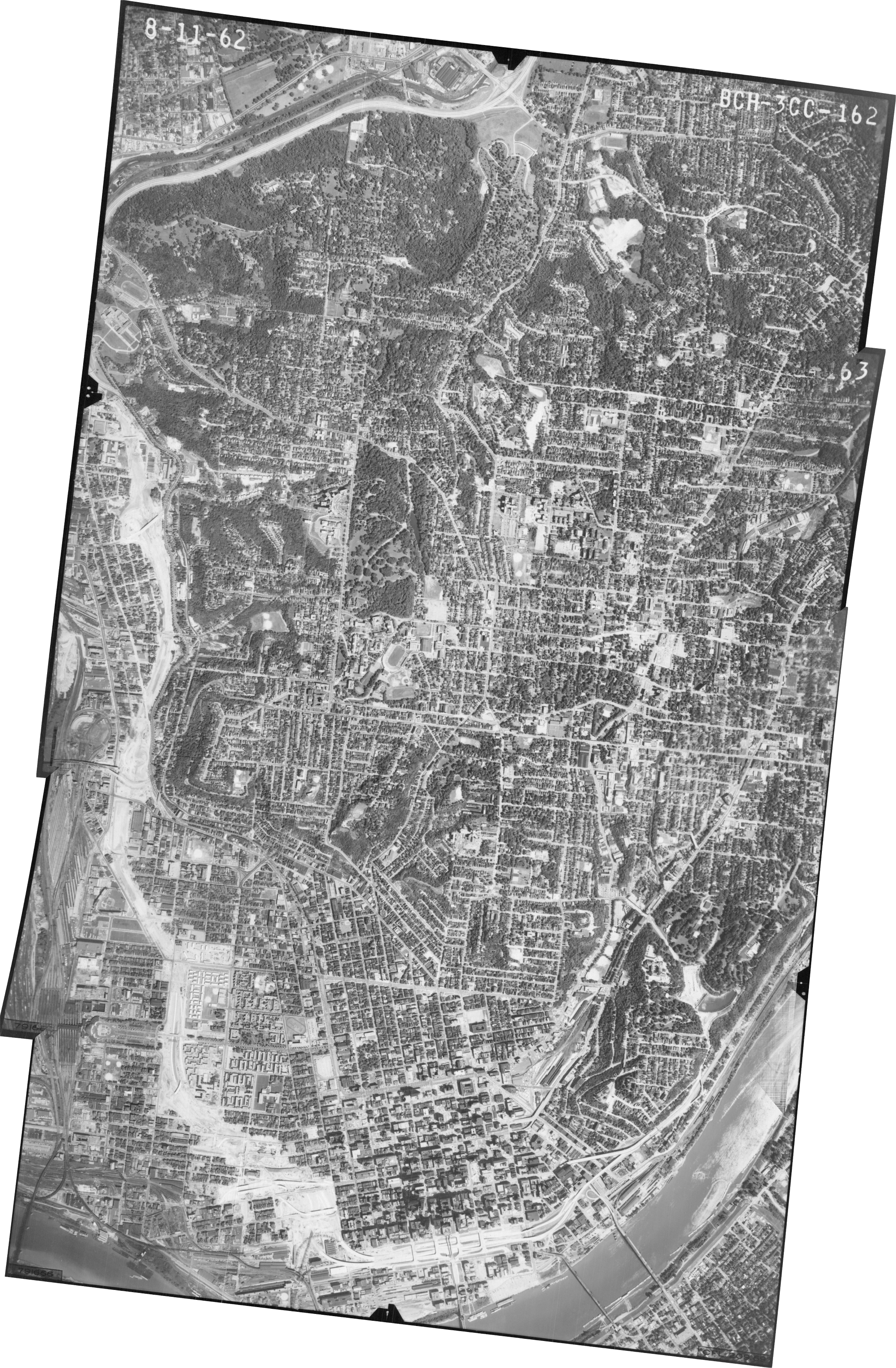
To demonstrate some of the capabilities of our lab and to showcase one of the GMP Library’s special collections, we selected a collection of historical aerial imagery of Cincinnati and Hamilton County from 1962. The goal of the project was to digitize these photographs and combine them into a single mosaicked image that contains important geospatial information.
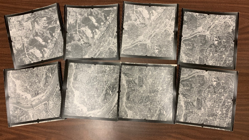 Using the GMP Library’s 36” wide document scanner, we created high-resolution images of the photographs. With the assistance of my R&DS team, these high-resolution images are then uploaded and opened in the free and open-source geographic information systems (GIS) software QGIS. In order to assign spatial data to the images (called rasters in GIS), we needed to connect the non-spatial images to real coordinates on earth through a process called georectification. We accomplished this by identifying identical points on both the non-spatial images and images that already contained geospatial information called ground-control points. A great resource for imagery containing geospatial information is the Ohio Statewide Imagery Program (OSIP), developed by Ohio Geographically Referenced Information Program (OGRIP) to provide free public access to high-resolution, rectified, and processed aerial imagery of each county in Ohio. We used the OSIP I aerial map of Hamilton County from 2007 and connected points on our images to points on the map to assign spatial data to our rasters. These individual images can now each be opened in QGIS along with any map of Ohio, and they will overlay in the correct location.
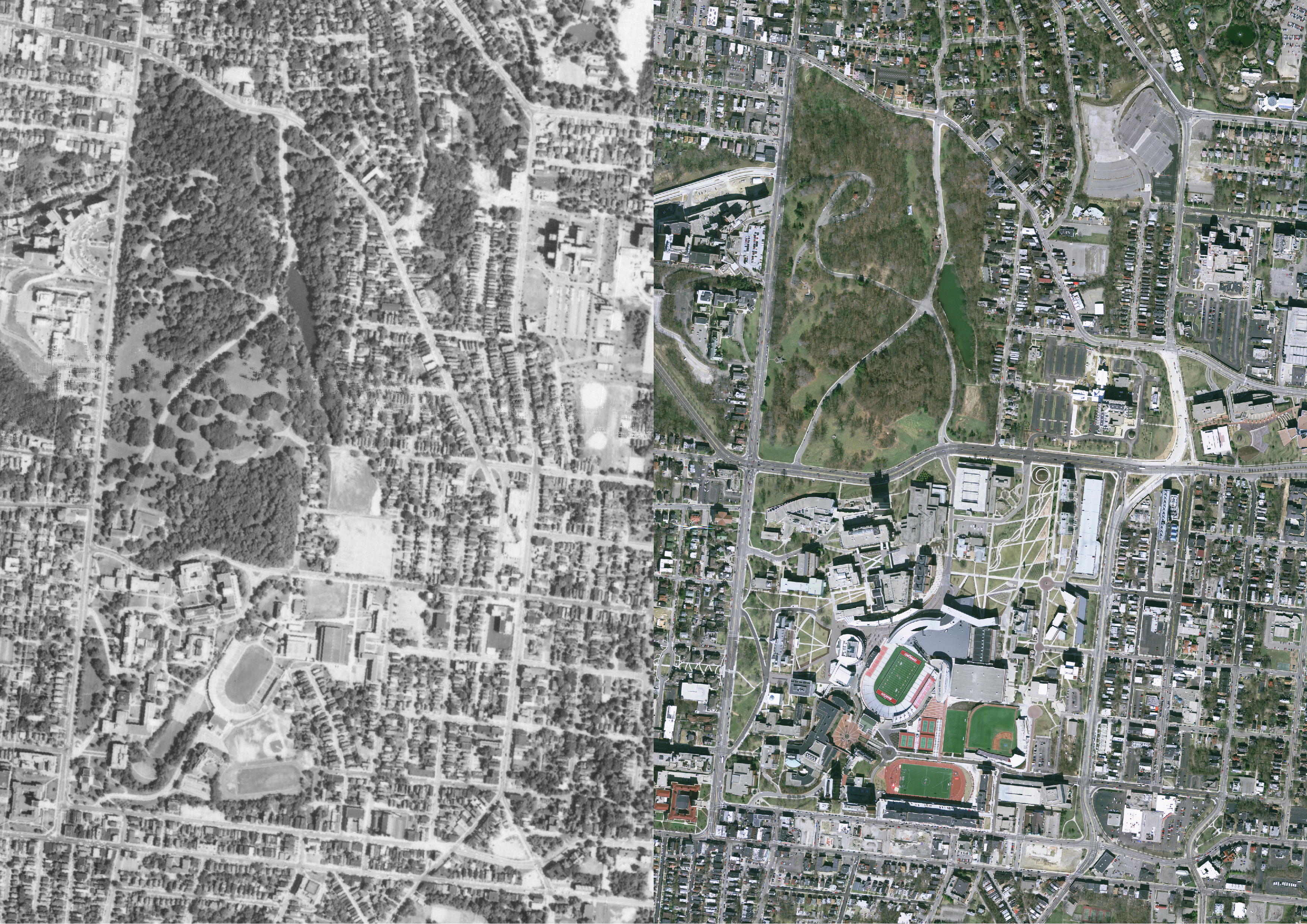
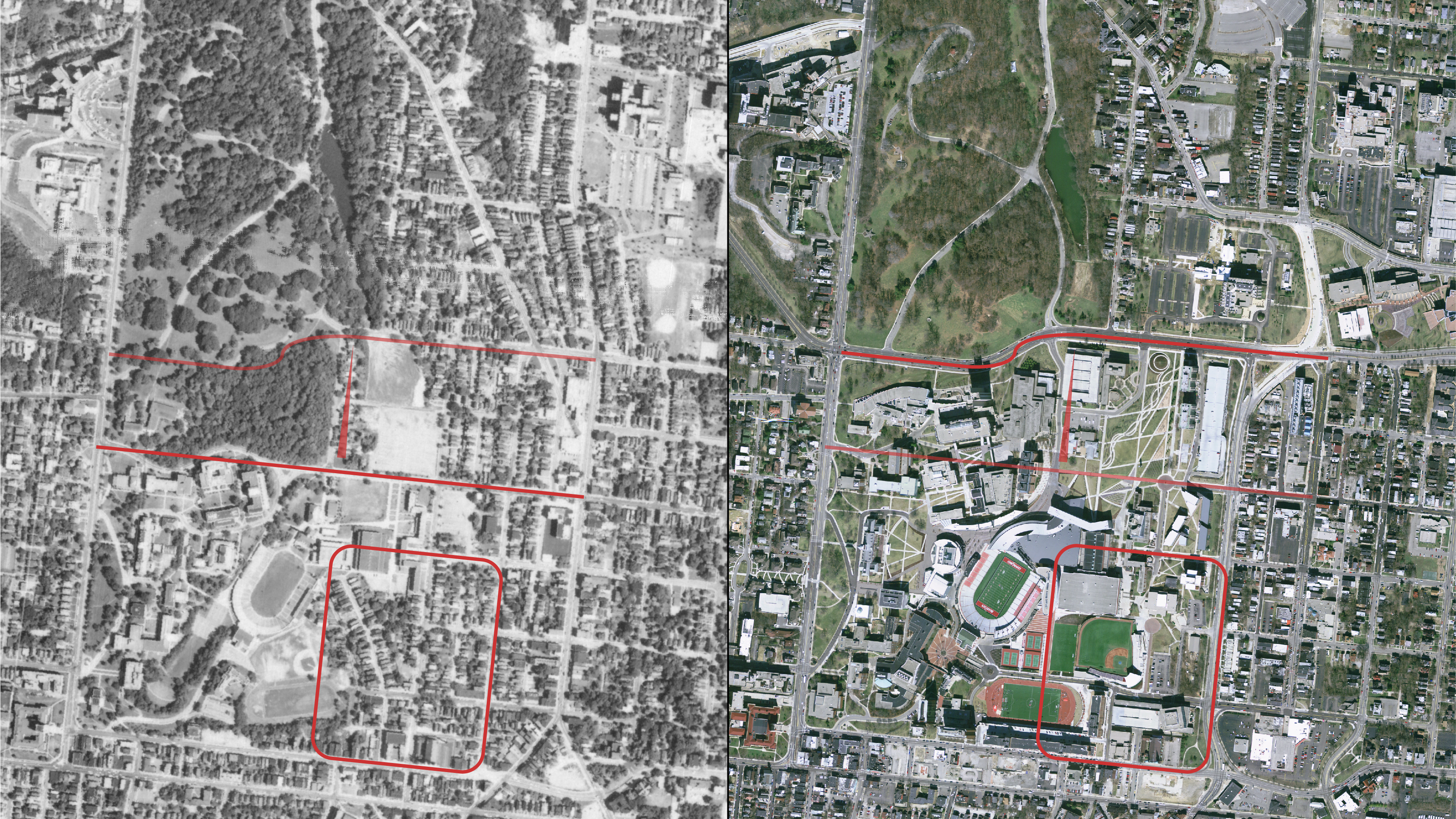
UC Campus c. 1962 and 2007
Once the rasters are successfully georeferenced, it does not take much more to have the program merge the overlapping images into one, seamless photographic map called a mosaic. By choosing the right options, one can weigh the calculations so that things like headings and dates are removed. For this project we wanted to choose historical images that would be approachable to the greater Cincinnati audience, so we created our final mosaicked image to encompass the Ohio River, downtown Cincinnati, and the entirety of UC’s campus.
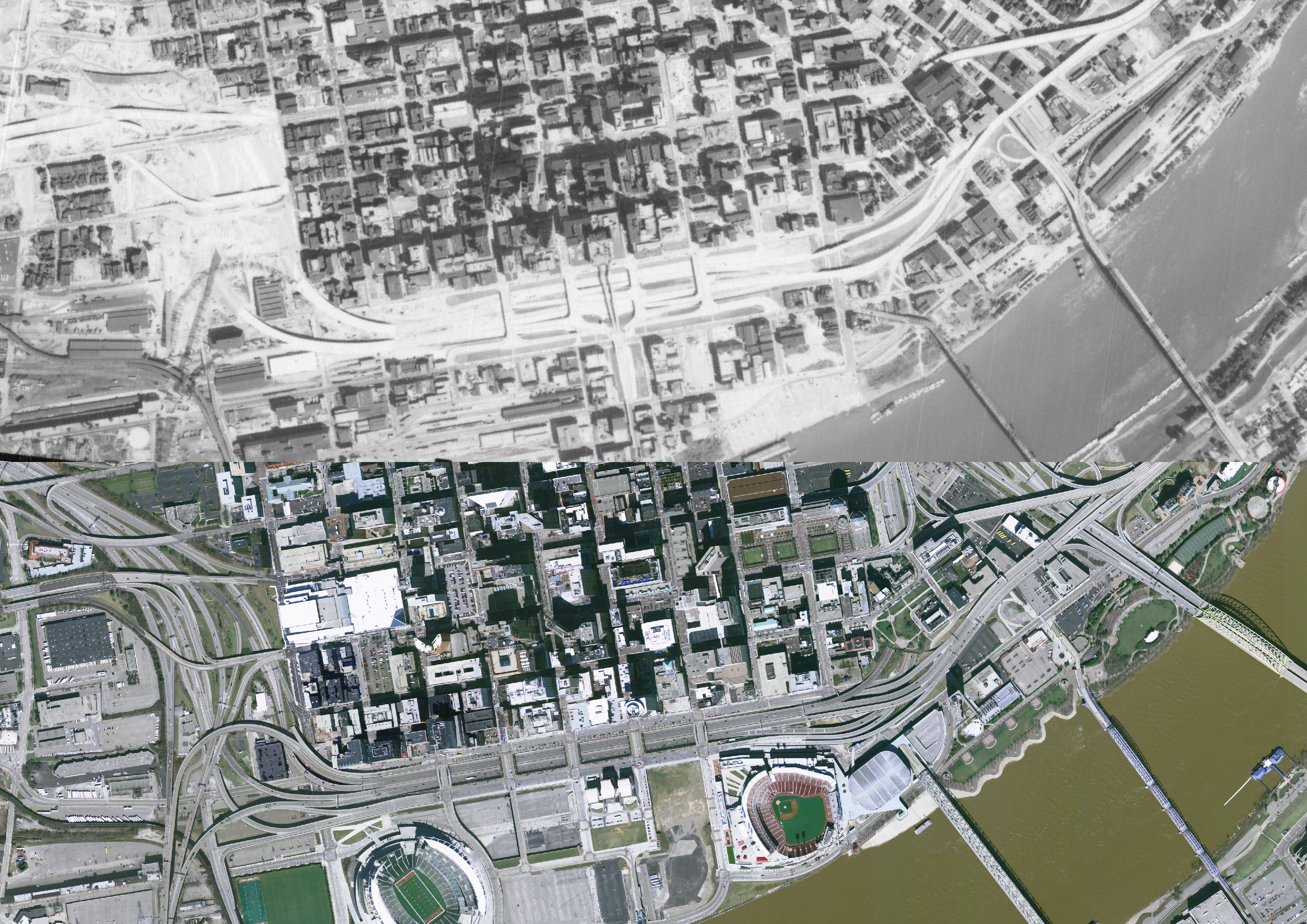
Cincinnati Riverfront c. 1962 and 2007
Just by visually exploring the difference between the historical mosaic and the modern aerial imagery, we can see dramatic changes in the area. In the mosaicked image below, we see that in 1962 I-71 hadn’t been built yet, but a large, blank space can be seen snaking north where entire city blocks and neighborhoods were cleared out for the construction of I-75. The Purple People Bridge was still connected to overpasses and roads, railways and shipping infrastructure lined the riverfront rather than stadiums, and much of UC’s current west campus was instead neighborhoods and Burnet Woods park.
For a high-res file of the mosaic image or for QGIS raster information, come to the Data & GIS Collab in GMP Library and ask! For access to UC Library’s extensive collections of aerial imagery, come to the GMP library.
As well as producing its own data-driven projects, R&DS provides consultations and workshops, and even facilitates collaborations between UC Libraries and researchers, students, and faculty across UC. The R&DS team is available in the Data and GIS Collaboration space on the main floor of the GMP library, in 240 Braunstein Hall, and is available for consult on GIS projects or anything related to data and the research process every weekday whenever classes are in session. Send an email to AskData@uc.edu to set up an appointment or swing by our little corner of the GMP library to find out when we are available.
Leanna Patton is a Chemistry graduate student and a student research consultant in the Data & GIS Collab, in the Geology-Math-Physics Library. She is a member of the UC Libraries Research & Data Services Team and can help with your research data questions.
