The Albert B. Sabin Digitization Project: New Finding Aid Available

By Mary Kroeger Vuyk, Sabin Student Assistant

I recently completed the processing of additional materials belonging to the Albert B. Sabin collection. This addendum to the original collection finding aid was received after Sabin’s initial donation of materials and consists of letters, lab data, photographs, and other items. A significant part of this collection reflects Dr. Sabin’s tenure as President of the Weizmann Institute of Science. The finding aid for this addendum can be found at the OhioLINK Finding Aid Repository.

This photo of Dr. Sabin and Hal Linden was taken at the 1990 Weizmann Founders’ event.

Continue reading

The Albert B. Sabin Digitization Project: Super Sabin!

By Mary Kroeger Vuyk, Sabin Student Assistant

In 1983, Amanda Magary wrote Dr. Sabin to tell him “Your [sic] my hero!”

Faster than a speeding bullet, more powerful than a locomotive, able to leap tall buildings in a single bound! It’s a bird. It’s a plane. It’s Albert Sabin? While many may view Albert Sabin as a super scientist or a super doctor, I’m not entirely sure that many would consider him a Superhero. And yet… that’s exactly how hundreds of thousands of people worldwide viewed him almost 50 years ago.

While I was aware of Dr. Sabin’s contribution, it wasn’t until I began going through the letters sent to Sabin that I started to fully understand the impact that he had on the lives of others. In one letter, Julie Harrison writes, “How much you have enriched the lives of all of us! Your oral vaccine for polio is surely one of the greatest accomplishments. We do thank you; you are truly an American hero.”[1] Continue reading

Supply In Demand-Acquiring Construction Resources in Post-WWI Cincinnati: Adventures in the Subway and Street Improvements Digitization Project

By: Angela Vanderbilt

In the spring of 1916, the citizens of Cincinnati voted in favor of the $6 million bond issue approved by City Council for construction of the “Pearl Street Belt Line,” a rapid transit loop that was to provide a solution to the congested traffic patterns in-and-out of downtown Cincinnati at the turn of the 20th century.

Map of Subway Construction area

March 1, 1921 – Photograph of a map of Cincinnati showing rapid transit loop & interurbans

Continue reading

Accidents Happen: Adventures in the Subway and Street Improvements Digitization Project

By Angela Vanderbilt

Sometimes, in order to build up you must tear down. Sometimes, progress comes with a price. In the case of the Cincinnati subway construction project, that price was the removal of several homes and businesses located along the proposed subway route. The razing of these buildings was due in part to their location, some lay in the direct path of the subway route, but also due to structural damage caused by the construction process.

All buildings were photographed as part of the subway project, including those which sustained damage due to construction of the subway. In some locations, vibration from blasting and digging resulted in cracked walls and ceilings. Below are images from 1921, the beginning of construction, that show cracks in foundations of structures located along the old canal bed, the new Central Parkway. Such photographs would be used to support property owner damage claims made to the city. It is reported that the city paid out over a quarter-million dollars in property damage reparations. Continue reading

The Albert B. Sabin Digitization Project: More to Check Out!

This fall, the Albert B. Sabin digitization project has been featured in several different places. I wanted to share all of them with you so you can check them out!

If you would like to see the slides from my presentation on the Sabin digitization project, please feel free to email the Winkler Center at chhp@uc.edu.

First, I want to tell you about my recent presentation at the Mid-Atlantic Regional Archives Conference (MARAC) Fall 2012 Meeting in October. My presentation, “The Albert B. Sabin Digitization Project: Reconstructing a Collection on the Web while Balancing Privacy, Restrictions, and Access,” was part of the session called, “Student Paper Session: Digital Reconstructions.” This was a great opportunity to discuss how Sabin project staff are dealing with sensitive issues, such as privacy and classified government information, in a digital collection. It was great sharing the project with the group at MARAC, and I even received a couple of questions at the end of the session. (MARAC plans to have all of their presentations from this meeting, including mine, available on their digital repository soon. Be sure to check it out!) Continue reading

Pairing Prints with Negatives: Adventures in the Subway and Street Improvements Digitization Project

By:  Angela Vanderbilt

The Cincinnati (Ohio) City Engineer – Rapid Transit Records collection includes both negatives and prints of subway construction and street improvement projects conducted by the City of Cincinnati between 1917 and 1957. While we are fortunate to have over 2000 printed copies from negatives included in the collection, not every negative has a matching print, and the digitization project does not extend to producing archival prints of the negatives. Because the prints and negatives have been separated into folders, with the negative folders organized by date and the print folders organized by street name, it is quite a task to match a print with a negative.

Like a game of Concentration, I compare prints to scanned images, hoping to match a print with its negative, spurred on by the challenge of turning over the right combination of cards! Fortunately, having gone through each folder to prepare the materials for scanning has made me familiar enough with the contents to have a general idea of where I might locate an image of Elm Street or Ludlow Avenue. Most helpful is the information being transcribed from the negatives and prints as they are scanned, which provides dates and street names in a spreadsheet that I compare and also match to the finding aid. As the project moves into the online collection building phase, each print will be matched with its negative in a database, so that ultimately researchers viewing the images on screen may quickly determine if a physical print is available. Continue reading

Cincinnati Then and Now: Adventures in the Subway and Street Improvements Digitization Project

By:  Angela Vanderbilt

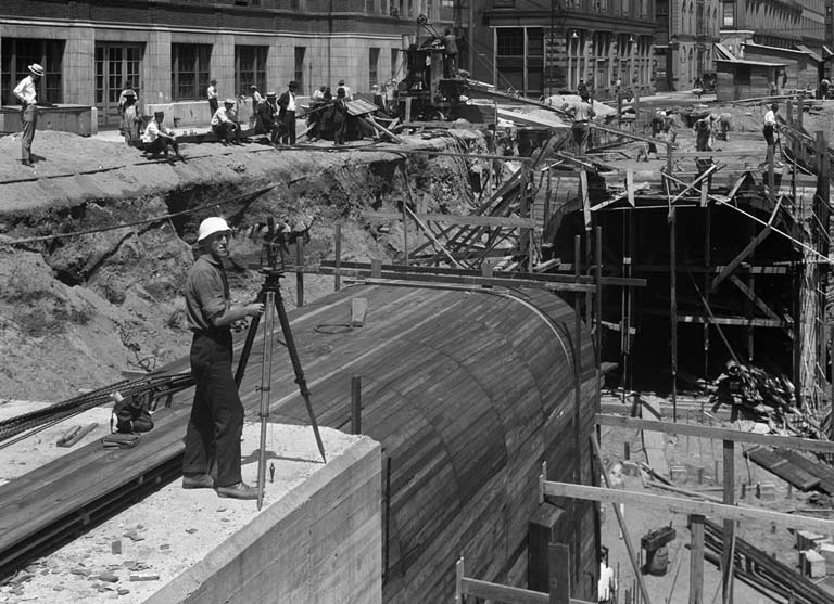
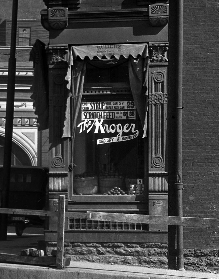
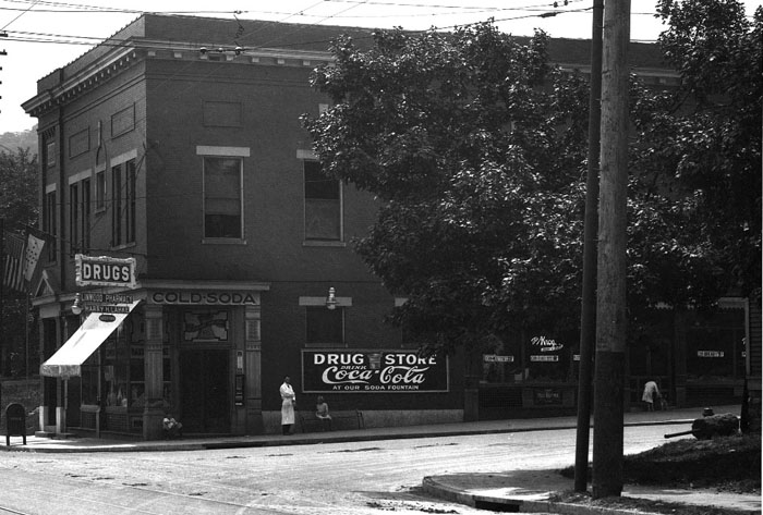
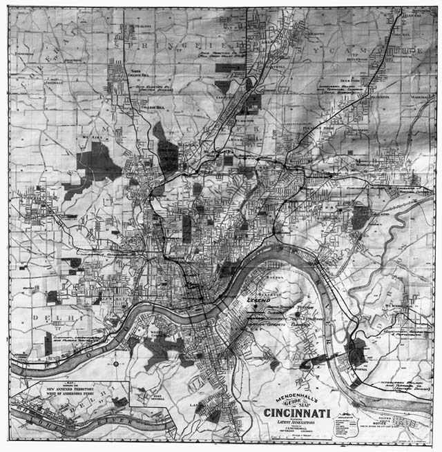
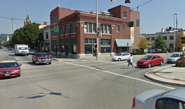
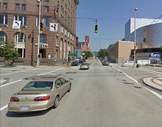
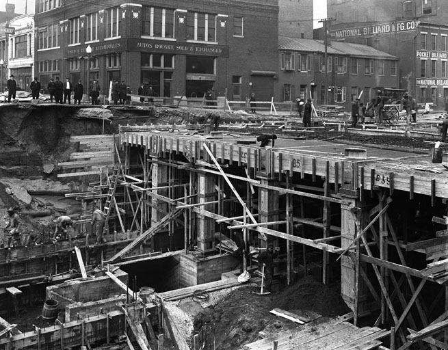
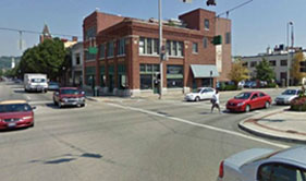
Reviewing the images of the subway construction has provided me with a great opportunity to learn the names of the streets and the different intersections around downtown Cincinnati that were major points along the subway route. As I learn to navigate my way around the city, driving from one location to another, I’m finding this very useful as I’m constantly recalling images and the navigational captions written on the negatives. By providing the street names and directional information for each image, the photographer gave us a map of 1920s Cincinnati. I thought it would be fun to show a “then and now” perspective of some of those streets and intersections, courtesy of Google maps, providing a snapshot of how much the city has grown and changed, starting with the removal of the canal in the 1920s.

The images shown here begin at Race Street and head west along Central Parkway, then make a turn at Plum Street to head north on Central Parkway past Mohawk Place (The building on the corner of Central and Mohawk Robin Imaging, the company digitizing the collection.), and north on McMicken Ave.

Race at Canal 1921

Northbound Race at Canal, 1921

Race at Central 2012

Northbound Race Street at Central Pkwy, 2012


Elm at Central

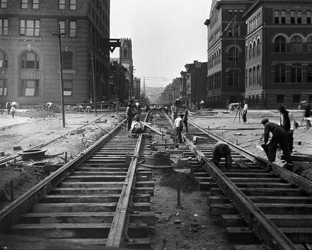
Northbound Elm St. at Canal St., 1921

Elma at Central, 2012

Northbound Elm at Central Pkwy, 2012


Continue reading

The Albert B. Sabin Digitization Project: Essays on Sabin

We are currently in the process of redesigning the current Sabin website, which is very exciting! For this new website, I have been doing some research to create new content and update content already there. Through my search, I came across some essays about Dr. Sabin written by Dr. Allen B. Weisse, a cardiologist and medical historian.

Letter from Allen B. Weisse to Dr. Sabin dated May 18, 1987. Dr. Sabin wrote a reply at the bottom of the letter.

In 1987, Dr. Weisse contacted Dr. Sabin about one of the essays that appeared in a book called Medical Odysseys: The Different and Sometimes Unexpected Pathways to Twentieth-Century Medical Discoveries. (The Sabin Archives has a folder of correspondence between Dr. Sabin and Dr. Weisse that discusses this chapter.[1]) They met later in 1987, when Dr. Weisse conducted an interview for this chapter.

Continue reading

A Changing Landscape-The Subway and Street Images Digitization Project Continues

By Angela Vanderbilt

An immediate advantage gained by the digitization of the subway construction negatives is that one can now easily follow the progress being made on the project. From images of the drained canal bed and the earliest scoops of dirt removed to shots of the broad parkway ready to receive pedestrian and automobile traffic, researchers accessing the images will be able to follow each step of the process, much like the crowds of curious onlookers who gathered daily to watch the event in the early 1920s.

Once the collection is made available online, viewers may easily follow the construction process for each section of the proposed route, thanks to the photographer who carefully documented each image by writing the date, time, and location of each photograph directly on the negative itself. Such information is an invaluable historic record of the project, and of the city of Cincinnati, and will be captured in a database to make searching for specific images within the collection that much easier.

Continue reading

The Best Show In Town

By:  Angela Vanderbilt

The construction of the subway seems to have been something of a spectator sport in Cincinnati, with groups of onlookers crowding along the banks of the old canal and hovering over the rails of bridges, watching as workmen dug out the canal bed to build the framework for tracks and tunnels.

Men looking over construction site Continue reading