By Tyler Morrison, ARB Student Worker
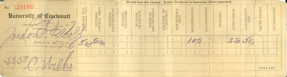
Oh, the things you can find when you go to an auction. Even the typical items that you find for sale, such as books, sometimes contain a surprise for the unsuspecting buyer. That’s exactly what happened to Linda Sheets of Jonesboro, Indiana when she bought a box lot of books and discovered a University of Cincinnati tuition receipt dated October 1, 1917. The strip of paper has yellowed with age, and fortunately Ms. Sheets realized it might have historical value for UC, and was kind enough to share her discovery with the Archives and Rare Books Library.
Jordon Alcott, the student from the 1917-1918 academic year, probably thought that $63.50 in tuition for one semester here at the university was expensive. That total comes from a $5 library fee, $50 for tuition to the College of Liberal Arts, a $ 1 registration fee, $2.50 fine to use the gymnasium, and a $5 contingency fee.
Continue reading →