
At the recent 2013 Society of American Archivists’ annual meeting in New Orleans, Louisiana, I presented a poster on the final results of the Albert B. Sabin digitization project. Several archivists stopped by to discuss the poster, particularly because they were curious about the way project staff handled documents that contained sensitive information. Many of those that stopped by were at archives in similar positions as the Winkler Center, trying to figure out the best way to balance privacy and access. Continue reading
Category Archives: Special Collections
Photographic Collections and Archive Repositories: A Balancing Act = Adventures in the Subway and Street Improvements Digitization Project
By: Angela Vanderbilt
The University of Cincinnati’s Archives and Rare Books Library (ARB) maintains numerous collections containing records of historic value for research and scholarly use. These materials are comprised of a variety formats, including printed documents, university records, sound recordings, and photographic prints and negatives.
One of these collections is the Ohio Network collection, comprised of historic local government and public records. The City of Cincinnati Engineer Records is part of this collection, and contains records produced by the engineer’s office from 1851 through 1957, including those of the Rapid Transit Commission for the subway and Central Parkway construction, as well as other street improvements carried out by the city within the same timeframe. And among these records are the negatives and photographic prints that are currently being digitized and that will be made available online via the ARB and Digital Collections web sites.
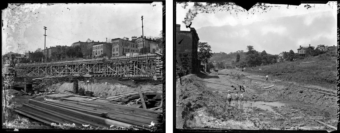
Nitrate negatives contained within City of Cincinnati Engineer Records collection
From Potter's Field to Union Terminal: The History of Lincoln Park = Adventures in the Subway and Street Improvements Digitization Project
By: Angela Vanderbilt
In my June 25 blog, “Ezzard Charles Drive: The Making of a Parkway,” I described how over time, many of the streets and locations captured in the Subway and Street Improvements images no longer exist, or have been altered in name or appearance, as they have been adapted for new uses. The area discussed in that blog is currently the site of the Cincinnati Museum Center, which occupies the former Union Terminal. Most residents of Cincinnati are familiar with the most current use of this building as well as its original purpose, a major railroad terminal by which passengers and freight from all over the United States passed through the Queen City. However, this area served two other purposes prior to the building of the terminal station, the first of which may surprise you. Continue reading
Cincinnati Street Names-A Who's Who of Cincinnati History = Adventures in the Subway and Street Improvements Digitization Project
By: Angela Vanderbilt
The subway and street improvements photograph collection is truly a wealth of historic information about the city of Cincinnati in the first half of the 20th century. As with most cities, many of the streets and avenues are named for the founders and prominent families who helped establish the city, as well as important statesmen such as presidents, governors and military heroes. Cincinnati has her fair share of these, with the city directories reading like a “Who’s Who” of Cincinnati’s political, cultural and economic development, with street names such as Ludlow, Symmes, and Patterson, St. Clair, Gamble and Ault, Anderson, Findlay and Wade, among others.
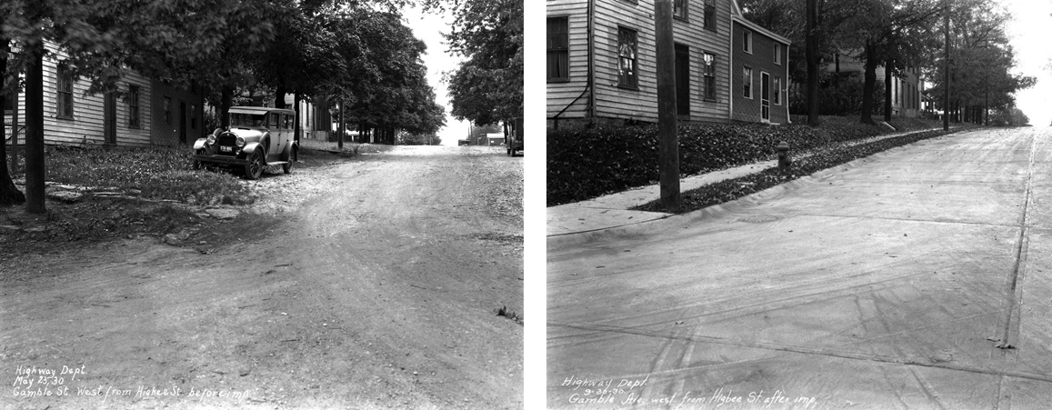
Gamble Street, named for industrialist James Gamble, of Proctor & Gamble.
Home Interiors of the 1920s = Adventures in the Subway and Street Improvements Digitization Project
By: Angela Vanderbilt
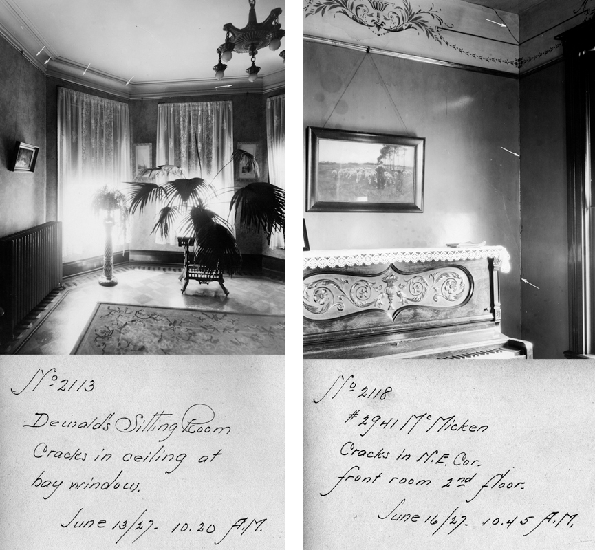
Contained within the subway portion of the photograph collection are images of the interiors of homes along McMicken Avenue taken during the construction of the subway. Originally intended to serve as evidence for claims by homeowners of structural damage to the houses caused by blasting for the subway tunnels, the pictures now serve as a historic reference of domestic life during the 1920s.
Ezzard Charles Drive, the Making of a Parkway
By Angela Vanderbilt
Road construction. It seems like it’s never ending. Some have joked that Ohio has only two seasons – winter and road construction. And the images in the Street Improvement collection would certainly seem to validate that. What is interesting about the images in the collection of street improvements is that many of the streets recorded in the photographs no longer exist. Or, where they do still exist, they are named differently or the surroundings have been altered to the point that the location in the photograph is no longer recognizable.
One major example of a street changing in both name and appearance is Laurel Street – or as we know it today, Ezzard Charles Drive. Originally a narrow street lined with brick row houses and businesses, Laurel Street extended from 1247 Plum Street west to Freeman Avenue, with the Cincinnati Symphony Orchestra Hall towering over the eastern end of the street, as if keeping watch over all who passed. In the winter of 1921, subway construction made its way north along the canal bed to the Laurel Street intersection, where a tunnel ventilator was constructed.
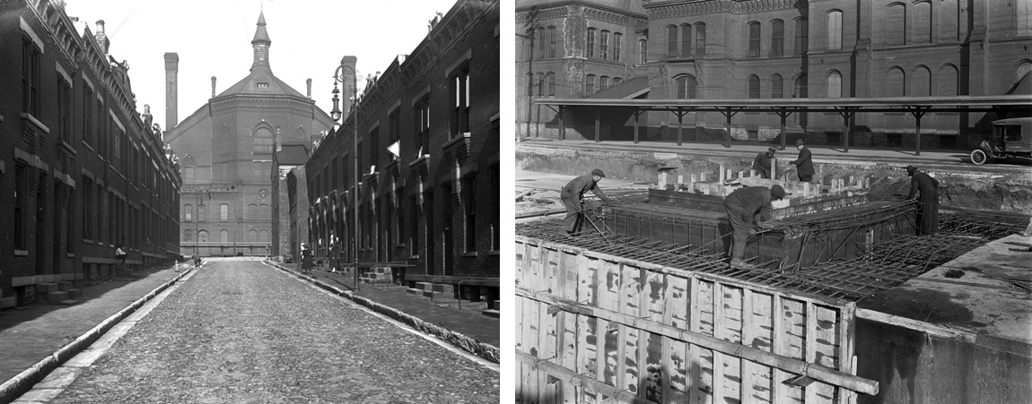
(Left) Construction of subway ventilator opposite Laurel Street, January 12, 1921, 2:02 p.m.
(Right) Laurel Street, west of Canal, with Cincinnati Symphony Orchestra Hall in center background, April 21, 1920, 3:47 p.m.
Paving the Way through Cincinnati = Adventures in the Subway and Street Improvements Digitization Project
By: Angela Vanderbilt
Downtown Cincinnati at the turn of the 20th century was a bustling business and commercial center, but with a dangerous mixture of pedestrians, horse-pulled wagons and carriages, street cars, and unseasoned automobile drivers. Add to this a mess of unpaved or cobblestoned streets, a lack of traffic laws, speed limits, and stop signs at intersections, with streetcar tracks criss-crossing lanes. It was a recipe for disaster.
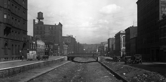
On the left, deliveries to the Raschig School are unloaded from a horse-drawn wagon while, on the right, automobiles park along a drained Miami & Erie Canal, looking east down Canal Street as subway construction begins, April 20, 1920
False Facades Offer Aesthetic Disguise = Adventures in the Subway and Street Improvements Digitization Project
By Angela Vanderbilt
The story of abandoned subway stations and tracks hidden beneath busy city streets is not unique to Cincinnati. Other large cities, such as New York, London, and Paris have similarly mysterious and intriguing stories to tell. An article I recently read in The New York Times introduced me to this underground world of hidden subway ventilation shafts disguised by false building facades, with doors from which people occasionally exit, but never seem to enter. Some of these subterranean secrets are in use, while others have been abandoned like Cincinnati’s own subway stations beneath Central Parkway.
What’s fascinating is the effort made to disguise these facilities, to blend them in with the neighboring buildings. While it seems a logically aesthetic means of making the utilitarian more appealing, some have argued that the cities in which these structures are located are trying to hide a deep secret. For comparison, consider the Cincinnati subway – when the subway and Central Parkway were first being constructed, the ventilation chimneys and the entrances to the below-ground stations were nicely appointed with decorative stonework.
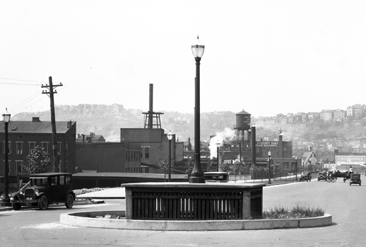
Ventilation shaft, looking north along Parkway from Liberty St., July 2, 1928
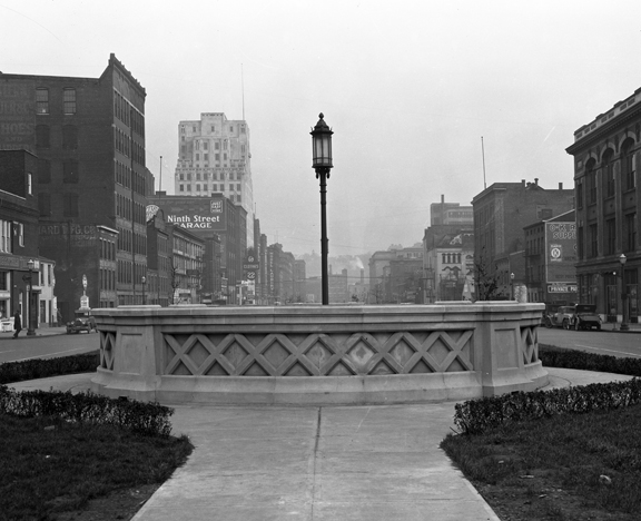
Close up of decorative stonework for ventilator railing, Central Parkway,
Nov. 19, 1928
Digitized Correspondence and Photographs of Albert B. Sabin Available on the Web
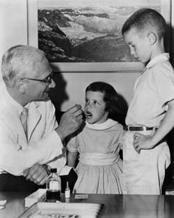 The University of Cincinnati Libraries have completed a three-year project to digitize the correspondence and photographs of Albert B. Sabin, developer of the oral polio vaccine and distinguished service professor at the University of Cincinnati’s College of Medicine and Children’s Hospital Research Foundation from 1939-1969.
The collection is freely and publicly available via the Albert B. Sabin website at http://sabin.uc.edu/ and includes approximately 35,000 letters and accompanying documents totaling 50,000 pages of correspondence between Sabin and political, cultural, social, and scientific leaders around the world. Also included are nearly 1,000 photographs documenting the events and activities worldwide that were part of Sabin’s crusade to eradicate polio. Continue reading
What Style is That? = Adventures in the Subway and Street Improvements Digitization Project
By Angela Vanderbilt
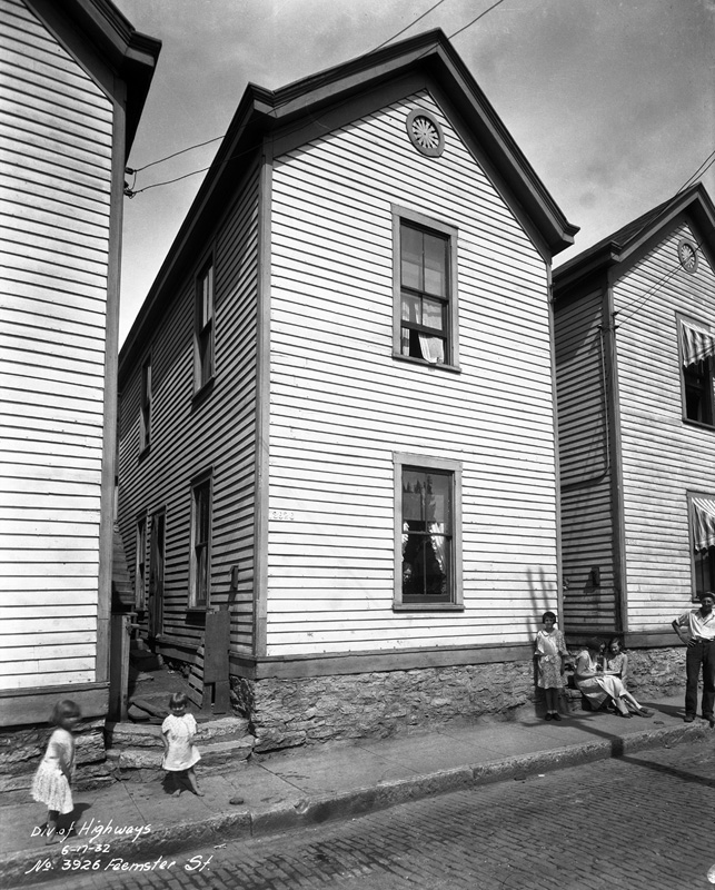
3926 Feemster Street, June 17, 1932
The photographs contained in the Subway and Street Improvements collection are a valuable source of information for anyone who might be researching the urban development and built environment of Cincinnati in the period surrounding the turn of the 20th century. Many of the images in the collection capture buildings and homes in Cincinnati’s downtown district and the surrounding neighborhoods as the city grew and expanded up the hills and along the Ohio River. And because the photographer wrote location and date information on the negatives, anyone interested in finding a picture of the house in which their grandparents or great-grandparents lived in 1923 may very well find it within this collection. Continue reading