The UC Science and Engineering libraries have recently added the newest collection of Morgan & Claypool’s Synthesis Digital Library of Engineering and Computer Science to its electronic resources. The books are on topics relevant to active research areas such as natural language processing and Human Computer Interaction.
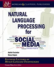 Natural Language Processing for Social Media
This book reviews the current research on NLP tools and methods for processing the non-traditional information from social media data that is available in large amounts, and it shows how innovative NLP approaches can integrate appropriate linguistic information in various fields such as social media monitoring, health care, and business intelligence. The book further covers the existing evaluation metrics for NLP and social media applications and the new efforts in evaluation campaigns or shared tasks on new datasets collected from social media.
https://www-morganclaypool-com.proxy.libraries.uc.edu/doi/10.2200/S00999ED3V01Y202003HLT046
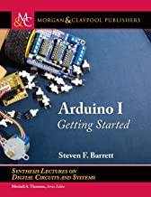 Arduino I: Getting Started
This book, Arduino I: Getting Started is written for those looking for a quick tutorial on the Arduino environment, platforms, interface techniques, and applications. Arduino II will explore advanced techniques, applications, and systems design. Arduino III will explore Arduino applications in the Internet of Things (IoT). Arduino I: Getting Started covers three different Arduino products: the Arduino UNO R3 equipped with the Microchip ATmega328, the Arduino Mega 2560 equipped with the Microchip ATmega2560, and the wearable Arduino LilyPad.
https://www-morganclaypool-com.proxy.libraries.uc.edu/doi/10.2200/S01001ED1V01Y202003DCS058
For the full list of recent books, click the “Continue Reading” link below.
Continue reading →
 The University of Cincinnati Libraries will be closed Thursday, November 26 and Friday, November 27 for Thanksgiving, with the Walter C. Langsam Library closing early on Wednesday, November 25 at 5pm.


 g for library print materials for research or study? The Click & Collect retrieval and pickup service (now expanded to a daily service!) allows UC users to request printed library materials in the
 While all UC Libraries’ physical locations remain closed until further notice, we are finalizing plans to provide users with access to print collection materials in order to support UC teaching and research.
 Natural Language Processing for Social Media
 Arduino I: Getting Started