3C GIS Day(s) Registration is open

Celebrate National GIS Day

GIS stands for Geographic Information Systems.  It is a powerful research tool to create, manage, analyze, and map data based on spatial attributes.

As in 2020 and again in 2021, UC is participating in the statewide 3C GIS Day and there are several ways for you to join the celebration:

1) Register to watch all the virtual events including the Keynote by Chris Fisher of the Earth Archive Project: Register for 3C GIS Day(s).

2) On Nov 17th @ 11 am in 400TUC, watch the Keynote over lunch with your UC Colleagues: Register for in person viewing event Deadline 11/8/2021

3) Showcase your own GIS work by giving a Lightning Talk: Lightning Talk Submission Form – Deadline 10/27/2021

4) Participate in the Map Gallery showcase:  Map Gallery Submission Form – Deadline 11/10/2021

Find more in-depth information on each part of the GIS Day celebration, please visit the event website – https://3cgisday.github.io/.


The event is free and open to all.  Registration is required.

Questions

For general event questions, please contact geospatial@osu.edu.

For the UC specific event, please contact Amy.Koshoffer@uc.edu

3C GIS Day(s) 2021: Save the Date and Call for Proposals 

3C GIS Day(s) 2021: Save the Date and Call for Proposals 

Save the Date 

Join us during the week of November 15-19 for a virtual GIS Day program featuring a keynote speaker, lightning talk sessions, and a digital map gallery. This event is free and open to the public, and registration details will be available soon. 

GIS stands for Geographic Information Systems.  It is a powerful research tool that makes use of the geospatial attribute of data.  One of the oldest and most famous examples is the map showing how John Snow was able to determine the source of a cholera outbreak in London from the location of sick individuals.   

 3C GIS Day(s) 2021 is a collaboration between Case Western Reserve University, The Ohio State University, and the University of Cincinnati. 

Lightning Talk Call for Proposals 

The 3C GIS Day(s) planning committee invites submissions for lightning talks (10 minutes) from any faculty, staff, or students affiliated with one of the three organizing institutions. We encourage submissions from any disciplines that use geospatial information in any format, such as agriculture and environmental sciences, geography, engineering, business, health sciences, urban planning, and the humanities and social sciences, among others. We especially encourage submissions from graduate and undergraduate students who would like to showcase their work through a fun and informal presentation opportunity. 

Please submit your lightning talk proposal by Friday, October 15Lightning Talk Submission Form. 

Information collected during the submission process includes presenter name and affiliation, availability during proposed sessions times, and presentation details (title, brief description, and any collaborators). 

If you have questions, please contact geospatial@osu.edu. 

Stay Tuned 

As part of this program, we’ll also be organizing a digital map gallery for affiliated faculty, staff, or students to showcase their original cartographic work, including both static and interactive maps. More information and a map gallery submission form will be available in the coming weeks. 

UC Libraries Research And Data Services Team is here to help you

Welcome back to campus and a really big Welcome

to new students, staff, and faculty.

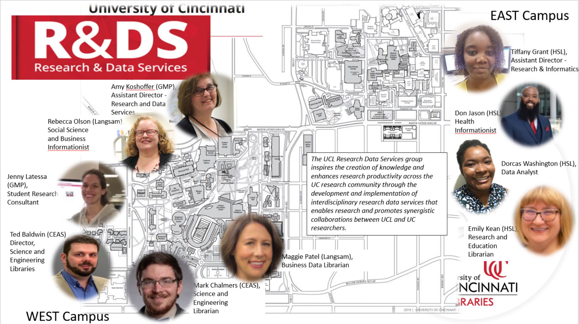
After you settle in and start to plan and implement your research projects, you may have questions about doing research here at UC.  The UC Libraries Research & Data Services is one of many support groups on campus to help you. We have information professionals and physical locations within various UC Libraries locations on East and West Uptown campuses to help all UC researchers.

We have vast and varied expertise and we can help you by

  • Supporting you throughout the research lifecycle
  • Helping you use tools such as:
  • Supporting Bioinformatic resource
  • Teaching and consulting on Data and Spatial analysis tools
    • SPSS, R, QGIS, ArcGIS (Desktop and Online)
  • Supporting data preservation and sharing resources
  • Explaining, finding, and using scholarly metrics i.e. impact factor, H-index, etc.
  • Explaining, finding, and using persistent identifiers such as ORCID and DOIs
  • Encouraging you to register for our workshops in Faculty OneStop
  • Teaching workshops focused on research and data recommended practices
  • Coming in for a consult at one of our locations.
  • Partnering with you on projects in scope with our mission and skill set.

We sponsor signature events such as Data Day (Nov 5th) and GIS Day (Nov 17th) through our Data and Computational Science Series and invite you to attend.  Here is a brief list of upcoming events and workshops focused on research.

August 31: Machine Actionable Data Management Plans And The Dmptool

September 8: R Introduction Workshop

September 14: ESRI’s StoryMaps

We are here to help you develop research efficiencies and make the most of your research.  We look forward to meeting you and hope to see you at our workshops and events.   And we are here so you get the information and resources you need, and we hope to partner with you on your research projects.

Contact us at:

Email – ASKDATA@UC.EDU 

Website – https://libraries.uc.edu/rds.html

UC Data Day Wrap-up

On Oct 23rd UC Libraries and IT@UC partnered for the 5th UC Data Day.  This year’s all virtual event featured, two power sessions, a Keynote by Glenn Ricart of US Ignite, and an interactive panel session of multidisciplinary faculty.

The event started with the first power session by George Turner, Indiana University’s (IU) Chief Systems Architect with IU’s Pervasive Technologies Institute (PTI).  Mr. Turner led participants through an introduction to high performance computing and demonstrated how to access the UC Advanced Research Computing (ARC) system.

Erin McCabe, Digital Scholarship Fellow with UC Libraries Digital Scholarship Center (DSC) led the second session on text mining and natural language processing.  Both sessions had a hands-on component with participants accessing the ARC system as well as engaging with the DSC platform for text mining.

Glenn Ricart of US Ignite gave a keynote address steeped in his own personal data that highlighted how much data one individual creates and how this data is being used to make policy decisions, drive business and help us image the future.  He also discussed the problems of our dependence on data and possible pitfalls and wrongdoings.

The closing session of the day was the interactive panel moderated by Michael Dunaway, PhD (UC Executive Director of the Digital Futures Resilience Program).  Dr. Dunaway started us off by asking two questions:

  • How is ubiquitous data changing your work as a Researcher, Educator, and/or Clinician, and its contribution to society?
  • How is ubiquitous data changing society and shaping our sense of community?

Six faculty from very different disciplines who use data in very different ways shared their perspectives on the keynote and the state of data literacy education at UC.  Glenn Ricart also participated in the discussion and affirmed the conclusions that was best stated by Whitney Gaskins (CEAS Assistant Dean and Assistant Professor- Office of Inclusive Excellence & Community Engagement) when she said “We need to educate students to be more numbers literate.”  Dr. Achala Vagal (MD, Radiology) expressed that the amount of data will only continue to grow per the example of medical imaging data and its storage needs.  Zvi Biener, PhD (Associate Professor Philosophy| History | Judaic Studies department, and the Center for Public Engagement with Science) highlighted how the approach to evaluating data changed with Newton, and we have to continue to question if we are truly gaining knowledge from all the data generated.  Both Prashant Khare (Asst. Professor, CEAS Aerospace Eng & Eng Mechanics, Chair, Advanced Research Computing (ARC) center) and Sam Anand (Professor, CEAS ME, Director – Siemens PLM Simulation Technology Center) discussed the need for jobs to adapt to the data rich environment and that if we are educating our students to be more numbers literate, they will cope better in the future work environment.  The panelists, Glenn Ricart and Michael Dunaway guided us through the changing and complex data rich world we now find ourselves and left us much to think about as to how our institute and community can face the challenges and ultimately benefit from this new environment.

Videos from the day are available on the STRC youtube page, as well as archived in a Data Day collection 2020 in UC’s institutional repository Scholar@UC.  We invite you to review the sessions and continue the dialogue at AskData@uc.edu or attend an upcoming Data and Computational Science series event.

Save the Date: GIS Day 2020

GIS Day is an annual event for students, staff, faculty, and the broader community to learn more about Geographic Information Systems (GIS) and to celebrate the power of geospatial analysis and visualization in answering research questions and solving real-world problems. This year, GIS Day is happening on Wednesday, November 18, and we hope you’ll mark your calendars so you can participate. We’re excited to bring you a different kind of GIS Day experience this year and to tell you a bit about what we have in the works.

In the past, we’ve hosted in-person GIS Day events, but we decided early in the discussions about returning to campus for autumn semester that this would not be a good idea in 2020. The first important change for this year is that we’re going virtual!

A virtual GIS Day provides us with a great opportunity to broaden participation in the program. Another important change this year is that our GIS Day 2020 program will be a collaboration between The Ohio State University, Case Western Reserve University, and the University of Cincinnati. Get ready for 3C GIS Day!

We’re in the early stages of planning, but we look forward to an exciting program that will include:

  • Lightning Talks
    • Learn about the application of geospatial technologies in a wide variety of disciplines from faculty, staff, students, and GIS professionals across Ohio’s 3C Corridor (Cleveland, Columbus, and Cincinnati).
  • StoryMaps Showcase
    • We’re inviting any students, staff, and faculty affiliated with The Ohio State University, Case Western Reserve University, and the University of Cincinnati to create and submit ArcGIS StoryMaps to showcase their work on GIS Day and beyond. More details about the StoryMaps Showcase will be coming soon!
  • Professional Networking
    • We will provide a venue for GIS professionals, researchers, and students from across Ohio to connect with one another and discuss experiences, opportunities, and current topics of interest in the world of geospatial.

In anticipation, there will be a StoryMaps workshop on October 5, 2020 from 10 am – 12 pm taught by the Research and Data Services team and hosted by the FEC.  Stay tuned for more information about this workshop and 3C GIS Day in the coming weeks and months, and mark your calendars for a great event on November 18, 2020!  The event is free and open to all.

The 3C GIS Day planning committee includes Josh Sadvari and Katie Phillips (OSU), Ben Gorham (Case), and Amy Koshoffer (UC). If you have any questions about 3C GIS Day or are interested in participating and want to receive updates, please email Amy Koshoffer at askData@uc.edu.


The Data & Computational Science Series presents – GIS Day 2019 Nov 13th

This year’s UC’s Celebration of National GIS Day is coming up on Nov 13th, 2019 and is organized by UC Libraries, UC Department of Geography and GIS, UC Joint Center of GIS & Spatial Analysis, UC Environmental Studies Program and the UC College of Arts and Sciences.

We invite you to come and celebrate with us.  Lunch will be provided and this event is free and open to all.

Please register at https://webapps2.uc.edu/ce/FacDev/Workshops/Details/13645.

Dr Hao Hu, Product Engineer with ESRI is the featured speaker and will present on the intersection of Machine Learning and Geographic Information Sciences (GIS) and how ESRI is addressing these opportunities in spatial applications with ArcGIS.   Dr Hao Hu is a product engineer in the Geoprocessing/Raster Analysis team at Esri, and works on large raster data processing that leverages distributed computing and storage technology. Before joining Esri, Dr. Hao completed his Doctoral degree in Geography from the University of Illinois at Urbana-Champaign (UIUC) researching on GIS and cyberinfrastructure, spatial decision support system, geospaital data uncertainty, and spatial optimization.

This talk is co-funded by the Provost Funded Data & Computational Science Series (awarded to UC Libraries and IT@UC Research and Development), the Graduate Student Association of UC and the Department of Geography – College of Arts and Science of UC.

The event will be held in 400 A-B TUC from 10 am to 2 pm

Hour Talk
10:00am Main talk (colloquium) -Machine Learning with ArcGIS
10:45am Coffee break
11:00am Practical session (Showcase) – Machine Learning in ArcGIS Platforms
1:00pm Lunch
1:30pm Link-GIS talk


The Data & Computational Science Series Presents: Research Computing: A View from the Trenches 

Posted on behalf of Amy Latessa,  Research Coordinator for IT@UC Research & Development

Coming up on Thursday November 7

The Data & Computational Science Series Presents: Research Computing: A View from the Trenches 

Visualization Lab (GMP Library, 240 Braunstein Hall)

11am – 1pm: Lunch & Learn with George TurnerChief Systems Architect for Research Technologies at the Pervasive Technologies Institute, Indiana University will give an insider’s presentation on research computing in higher education. George has helped build one of the most abundant and successful research centers in the United States and has been assisting the University of Cincinnati to set up its first ever Advanced Research Computing Cluster, now available to UC faculty and students.  His talk will address challenges in research computing and HPC and share the benefits that a successful University research computing center can have upon a research institution.

1:30pm – 3:30pm: Linux 101 Workshop: This free workshop will provide a brief introduction on the layout of the Linux operating system. It will overview Linux concepts with a few exercises and will help people to understand the paradigms and why this is important in the bigger scheme of things.
No prerequisites. No scripting. Please Bring a Laptop.

All events are free. Registration is required.

Flyer: Turner_DCSS_Nov7

Contact Amy Latessa at latessak@ucmail.uc.edu for more information


Student Research Consultant’s experience at the XSEDE Big Data Workshop

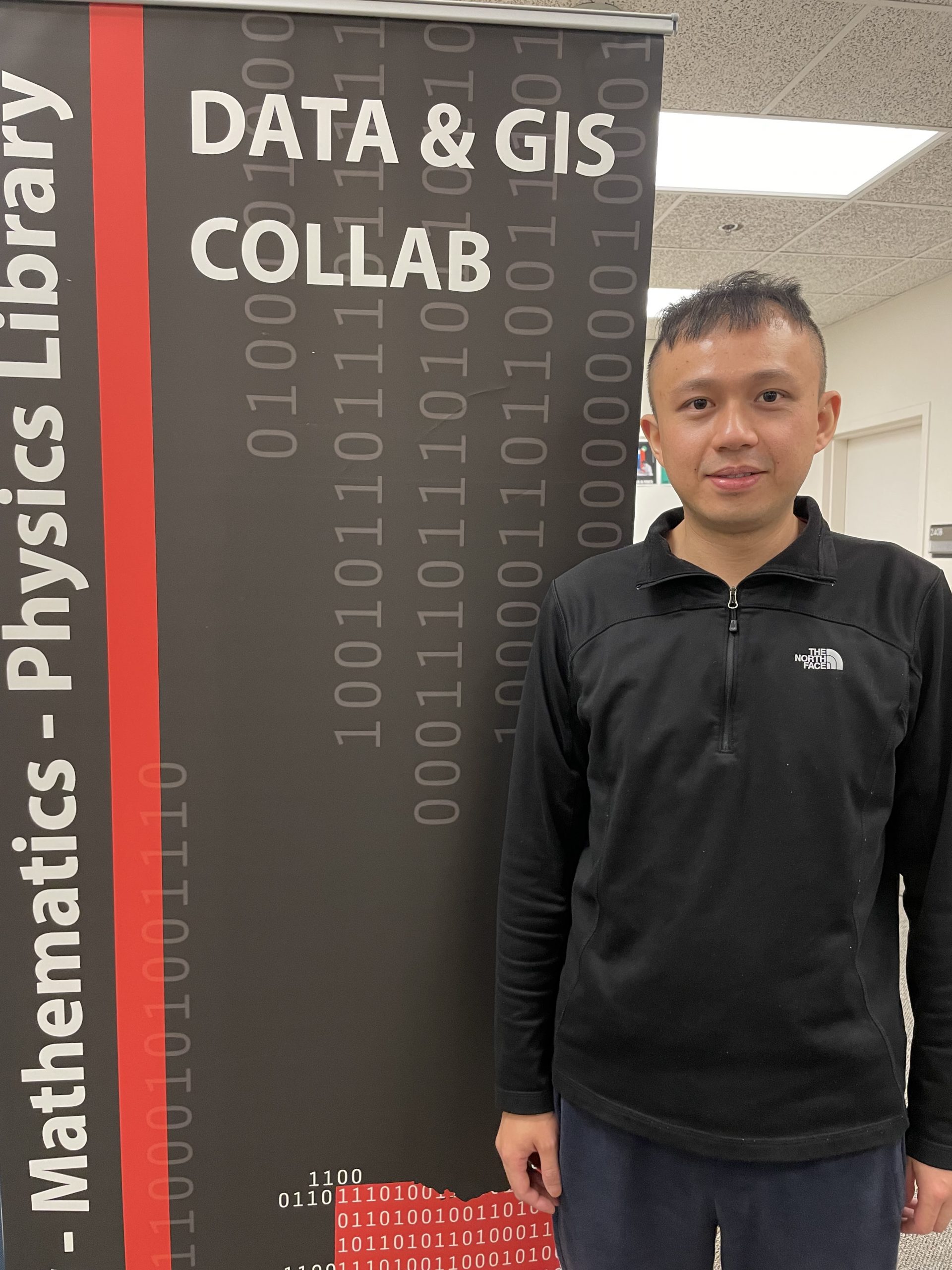
Zhiyuan Yao is a Geography PhD candidate and a student research consultant in the Research Labs@ GMP, in the Geology-Math-Physics Library.  She is a GIS expert in the UC Libraries Research & Data Services Team and can help you with your GIS and other research data questions.  Below she describes her recent experience attending the XSEDE workshop on Big Data.

The Extreme Science and Engineering Discovery Environment (XSEDE) is an NSF-funded virtual organization that integrates and coordinates the sharing of supercomputers with researchers nationally to support science. It has five computer resource infrastructures located across the nations, and Pittsburgh Supercomputing Center (PSC) is a part of it. PSC offers workshops from time to time through the year and aims to promote advanced data analysis among a variety of research fields using its supercomputer, Bridges. Thanks to IT@UC Research & Development, Innovation and Partnerships, who cooperates with PSC to offer the free workshop to UC community. The workshop is one of many events in the Data & Computational Science Series funded by the Provost Office.  I was glad to attend the Big Data workshop and give you a glimpse of the informative workshop.

The Big Data workshop was held on Oct 1st to Oct 2nd, from 11: 00 AM to 5: 30 PM. The workshop was well organized and followed a working flow: introducing background information, providing examples, and doing exercises. I really appreciated the background information introduced in this workshop, since it provided a holistic view of this workshop which was friendly to beginners. Besides, this workshop talked about several programs for big data analysis, such as Hadoop and Spark, and Tensorflow. The Big data workshop is one of PSC HPC workshop series, such as MPI, OpenMP, OpenACC, et al. If you are interested in one of these workshops, you can check if IT@UC offers this workshop at Workshops & Trainings in Faculty OneStop.

lunch options at the XSEDE workshop

Besides the free knowledge, you also have free lunch! IT@UC Research & Development, Innovation and Partnerships offered the yummy lunch through the Data & Computational Science Series funded by the Provost Office. If you are interested in learning things about high performance computing, please come and take advantage of the free resources and the yummy lunch!


The next XSEDE event is coming up soon:

XSEDE Monthly HPC Workshop: OpenMP

Tuesday November 5, 2019 – 11:00am to 5:00pm
Langsam Library Room 475

Research Labs @ GMP Library News update – Zhiyuan Yao Attends the AAG-UIUC Summer School

Zhiyuan Yao is one of two GIS support students working in the Research & Data Service research labs at the Geology Math and Physics Library.  The Data & GIS collab is open to students, staff and faculty seeking help with their geospatial data needs, and the Visualization lab is open for data visualization consultations and collaborative work.  Email us at ASKData@ucmail.uc.edu for more information.  

Great learning and collaboration experience in AAG-UIUC Summer School

This summer in July, I was honored to be offered the opportunity to attend AAG-UIUC 2019 Summer School, which focused on Reproducible Problem Solving with Cyber GIS and Geospatial Data Science. During the one-week summer camp, I met many scholars, got access to the supercomputer Virtual Roger through CyberGIS-Jupter, learned the cutting-edge advances regarding geospatial data science, and got a deeper understanding about reproducibility and replicability. I absolutely had a wonderful time there, and this experience provoked me to think more about how we could develop novel solutions to complex problems.


Participants in the AAG-UIUC summer school with mentor Diana Sinton (Ex Director of UCGIS in the  green shirt) in the middle.

Continue reading

XSEDE High Performance Computing (HPC) Boot Camp

Posted on behalf of Amy Latessa,  Research Coordinator for IT@UC Research & Development

The Data & Computational Science Series presents:
XSEDE High Performance Computing (HPC) Boot Camp

Free Registration (required)

Description: This 4-day event will include MPI, OpenMP, OpenACC and accelerators. This event will be presented using the Wide Area Classroom(WAC) training platform and will conclude with a special hybrid exercise contest that will challenge the students to apply their skills over the following 3 weeks and be awarded the Fifth Annual XSEDE Summer Boot Camp Championship Trophy.  In addition, an XSEDE Badge will be available to those who complete the Challenge.

Tentative Agenda

When: June 3-6, 2019

Location: Langsam Library room 462

2911 Woodside Drive
Cincinnati, OH 45221


Note: You need an XSEDE account to register Create Account

Parking: Woodside Avenue Garage

Special Instructions: Participants should bring their own laptop, lunch will be provided.

Questions? Contact Amy Latessa 

XSEDE (eXtreme Science and Engineering Discovery Environment) is a virtual system that provides compute resources for scientists and researchers from all over the country. Its mission is to facilitate research collaboration among institutions, enhance research productivity, provide remote data transfer, and enable remote instrumentation. XSEDE is funded by National Science Foundation (NSF).  Getting Started Guide for XSEDE.