2017 GIS Day Celebration

 GIS stands for Geographic Information Systems and is a powerful technology for data analysis, visualization and interpretation to understand spatial patterns and trends.


Sponsored by A&S Department of Geography & GIS and UC Libraries –

You are invited to the 2017 GIS Day Celebration November 15, 2017

in the beautiful Nippert Stadium West Pavilion North Lounge.

The event is free and open to all.

Event Program:

11 – 12 pm  Professional talk
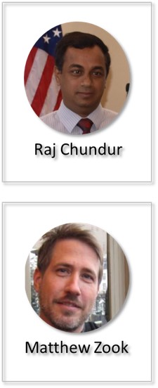
  “GIS in Local Governments – A Decision Making Framework”

– Raj Chundur (Cincinnati Area GIS Administrator)

12 – 1 pm   Lunch

1   – 2 pm   Academic talk

  “Crowd-sourcing the Smart City: Big Geosocial Media Data, Ethics and

Urban Governance”

– Dr. Zook (University of Kentucky)


Raj Chundur is the CAGIS Administrator for the City of Cincinnati

Cincinnati Area Geographic Information System (CAGIS)

Matthew Zook PhD is Professor of Economic Geography at University of Kentucky. His research focuses on how the geoweb is produced (particularly the practices surrounding user-generated data) in order to better understand where, when, and by whom geo-coded content is being created.  He is a well published researcher and a contributor to the research blog FloatingSheep.

Questions? E-mail Amy Koshoffer, science informationist, at ASKGIS@UC.EDU for more information.

Flyer – GISDAY_2017_1
Mapathon @ UCLibraries


On Nov 4th, The Red Cross will hold a Missing Maps Mapathon at UC Libraries in 475 Langsam from 10 am to 2 pm.  The information collected from a Mapathon helps the Red Cross identify the best locations to bring in emergency supplies, where to house emergency operations and what local resources they can collaborate with in emergency response efforts.  In order to participate, you do not need extensive mapping experience.  The maps are creating using the Open Street Map platform and you can learn quickly by watching a training video.

If you are interested to participate, please register here – https://goo.gl/forms/Ln4LdEKcFNc7CUTt2 and watch the training video.

Please contact Amy Koshoffer – ASKGIS@UC.EDU if you have questions about the event.

More information in the attached flyer. GIS_LC_20171011_MissingMapsFlyer

Congratulations to CEAS Environmental Researchers

We offer a big congratulations to Patcha Huntra and Tim C. Keener 

from the CEAS Department of Biomedical, Chemical and Environmental Engineering,

for their recent publication in ISPRS International Journal of Geo-Information entitled

Evaluating the Impact of Meteorological Factors on Water Demand in the Las Vegas Valley Using Time-Series Analysis: 1990–2014. 

http://www.mdpi.com:8080/2220-9964/6/8/249/htm

Patcha visited the Data & GIS Collab for assistance getting the last piece needed for this article.

Together with the GIS support Students, Jenny Latessa (DAAP) and Shiyu Gong (Geography), they created a map of the study area.

We are happy to see the final published version is now available.  Congratulations and we hope you visit the Data & GIS Collab again.

Coming Soon – Center for Open Science Workshop – Oct 25th


Members of the CCDC – Ruoxia Zhao, Emily Westbrook, ReJeana Cary, DeVonna Gatlin, Priti Thakur (kneeling) Zhao Yu, Becca Haley, Niranga Wijesiri and Megan Schmale showing off their beautiful COS tee-shirts

UC Libraries and The Graduate School are pleased to host the Center for Open Science for a workshop on Increasing Openness and Reproducibility in Quantitative Research on October 25, 2017The workshop will cover project documentation, version control, pre-analysis plans and the Open Science Framework.  There will be two sessions of the workshop, one on East campus and one on the West campus.  The event is free and open to all.  To register, visit https://goo.gl/Hf5neh.  Participants are asked to bring their own device for best workshop experience.

 Questions? Please email Amy Koshoffer at ASKDATA@UC.EDU for more information.

 Workshop Information:


Date: October 25, 2017

 Session 1

Time: 9am – 12pm

Location: East Campus – Troup Learning Space – MSB G005G

 Session 2

Time: 1:30pm – 4:30pm

Location: West Campus – 480 Langsam Library


OpenRefine Workshop on October 31

UC Libraries is pleased to offer a new data science workshop this fall on OpenRefine. Join us in 850D Baldwin Hall (CEAS Library classroom) on Tuesday, October 31 from 10:00am – 12:00pm.  Register here (Central Login required).

OpenRefine, http://openrefine.org, is a free, powerful, and easy-to-use tool for cleaning up and transforming datasets in order to prepare them for analysis and sharing. In this workshop, you will learn how to leverage OpenRefine’s interface and scripting language for basic data exploration and bulk transformations. No prior knowledge necessary.  Please bring your own laptop for the hands-on exercises.

Contact Ted Baldwin with questions, Ted.Baldwin@uc.edu .

Ohio Supercomputer Center Workshop – Oct 10th

Posted on Behalf of Jane Combs –  combsje@uc.edu.

The Ohio Supercomputer Center will offer two workshops on its resources and how to use them Tuesday, October 10, on both East and West campuses.

IT@UC Research & Development will be hosting the Ohio Supercomputer Center for two workshops on Tuesday, October 10. The morning workshop will provide an introduction to the Ohio Supercomputer Center resources and how to use them. In the afternoon, the workshop will cover Big Data Analytics and Spark.

Register for the workshops HERE

The Ohio Supercomputer Center, headquartered in Columbus, partners with Ohio researchers to develop proposals to funding organizations and is the state’s leading strategic research group.

Continue reading

Most UC Libraries Closed Labor Day, September 4

labor dayUC Libraries will be closed Monday, September 4 for Labor Day, except for the Donald C. Harrison Health Sciences Library, which will be open 9am-5pm. This closing includes the Langsam Library 4th floor space, which will close Sunday, September 3 at 11pm and re-open Tuesday, September 5 at 7:45am.

A complete listing of library hours can be found online at www.libraries.uc.edu/about/hours.html.

Enjoy the long holiday weekend.

GIS Learning Community – First Meeting for 2017-2018

 GIS stands for Geographic Information Systems.  GIS has applications for both teaching and research across many disciplines.

Do you need to visualize your spatial data but don’t know how? Do you have spatial data but don’t know how to map it?  Are you looking for guidance or have expertise to share regarding the analysis of spatial data?  Are you an ArcGIS, Q-GIS or other GIS program user and want to connect with other people who use these programs?  Are you simply curious about GIS and want to learn more?

The GIS Learning Community can help you address these and other questions.  The goal of the community is to be a user-driven forum for novice and expert practitioners to come together and discuss tools, resources, projects and solutions surrounding the spatial aspects of their data.   We invite interested individuals across all of UC to join us in building this community. The community is open to All Faculty, Staff and Students, as well as interested parties from outside of UC.  Please share with your colleagues and students.

The Details –

Date: September 6, 2017

Time: 3:00 to 4:30 pm

Place: (VENUE CHANGE 480 Langsam)

Light refreshments will be served

RSVP and Join the GIS LC at https://form.jotform.us/72324913145149.

If you are interested in the GIS Learning Community and are not able to come to the first meeting, RSVP or email ASKGIS@UC.Edu to be added to the GIS LC email list. Future invites will go to the GIS LC email list only.

More information is available on the GIS LC page on the GIS research guide:  http://guides.libraries.uc.edu/GIS/GISLC