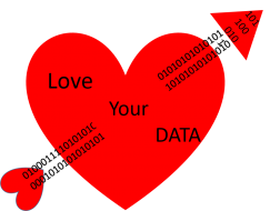
Jerry Sheehan Post’s on Federally Funded Research Results and Accessibility

At the close of the 8th Open Access Week, Jerry Sheehan of the White House Office of Science And Technology Policy blogged about the impact of openly accessible research findings, especially federally funded research.

Three more agencies have announced public access plans (Department of Education (ED), Agency for International Development, and Office of the Director of National Intelligence (ODNI)), bringing the total to 19.  A good resource for understanding the requirements of the plans is the  the Scholarly Publishing and Academic Resources Coalition – http://sparcopen.org/ and the data sharing resource http://datasharing.sparcopen.org/ available through SPARC.

To read the complete blog post,  click here.

October GIS Learning Community Meeting

The October GIS Learning Community meeting agenda will be a great tour of several software approaches.

The meeting is Oct 26th from 3:15 to 4:25 in 462 Langsam.

  • Tony Quallan of UCIT will join us for a brief informational talk about getting access to ArcGIS and the support offered through UCIT
  • First Lightning Talk Presenter  – Ben Merrit, Graduate Student in Biology will discuss how the Culley lab uses ArcGIS to investigate plant genetics and biodiversity
  • Second Lightning Talk Presenter  – Chris Sheehan, Graduate Student in Geology will discuss using Google Earth and ArcGIS to study process-based Geomorphology
  • In-depth Presentation Presenter – John Wallrodt, Sr Research Associate in A&S Classics will discuss the use of ArcGIS and QGIS by archaeology researchers.

Contact Amy Koshoffer, Science Informationist at koshofae@ucmail.uc.edu with questions.

Big Bone Lick Display is now open at GMP

Stop by and see what is new in our library.  On display are tusks and bones of mastodons and other now-extinct massive creatures known collectively as the Pleistocene Megafauna.

bblgroup

We are hosting one of the four Cincinnati Museum Center exhibits now on UC’s campus.  If you want to find out more about other exhibits go to http://www.cincymuseum.org/curate-my-community. 

Nature Asks – Where are the data?

Starting in October, researchers publishing in Nature and 12 other Nature titles will have include information on whether and how others can access the data supporting the article.  This means authors will need to compose a Data Availability Statement.  The full policy is available at go.nature.com/2bf4vqn) and more information is on the Nature blog.

Scholar@UC, our own institutional repository, would be the right tool to help comply with this new policy.  If you need more information or help with access to Scholar@UC please Contact the Scholar@UC Team or a UC Libraries informationist.

Tiffany Grant PhD,  Research Informationist at tiffany.grant@uc.edu

Don Jason Clinical Informationist at don.jason@uc.edu

Amy Koshoffer Science Informationist at amy.koshoffer@uc.edu


Paper featuring Scholar@UC Gets Best Research Paper Award!

Congratulations to Dr. Nan Niu and his research team!re16_bestresearchpaperaward_niu

Recently Dr. Nan Niu traveled to Beijing, China to attend the RE16 conference- Requirements Engineering16 http://re16.org/downloads/RE16%20program.pdf. He took with him high hopes for the requirements engineering research paper he and his team submitted together with Linda Newman, Head of Repositories and Digital Collections and Amy Koshoffer, Science Informationist. For the beginning of this story and more on the models created using Scholar@UC use cases, see the blog entry “Scholar@UC Goes to Class” (https://libapps.libraries.uc.edu/liblog/2016/01/scholaruc-goes-to-class/).

Dr. Niu has made all the research materials supporting this work available through Scholar@UC https://scholar.uc.edu/works/documents/wm117q084.  Dr. Niu is making brilliant use of Scholar@UC as a teaching tool, a research subject, data preservation tool and an open data/access model.  Again congratulations to Dr. Niu and the whole team!!

September Program for GIS Learning Community

September program for the

UC GIS (Geographic Information Systems) Learning Community.

Date: Wed Sept 28, 2016

Time: 3:15 – 4:25

Venue: Langsam 462

We have three presenters who will talk on very diverse topics.

1st Lightning Talk – Carolyn Hansen – Metadata Librarian, UC Libraries –Digital Humanities projects using GIS visualizations and discuss how GIS applications can be used to answer humanities research questions.

2nd Lightning Talk – Jeremy Koster – Assoc Professor, A&S Anthropology – Using GIS and remote sensing to understand the spread of the agricultural frontier in the rain forests of Nicaragua

In depth presentation – Jeffery Timberlake- Assoc Professor, A&S Sociology – Understanding and accessing census data

We will also be joined by James Lee who will talk briefly about the Digital Humanities and Scholarship Center and his role as Co-Director and his vision for the center.

New Venue for GIS Learning Community

Due to the great response and interest in the GIS Learning Community, we are moving the venue to 201 Braunstein Hall located just down the hall from the GMP Library.


UC GIS Learning Community Forming


Do you need to visualize your spatial data but don’t know how? Do you have spatial data but don’t know how to map it?  Are you looking for guidance or have expertise to share regarding the analysis of spatial data?  Are you an ArcGIS, A Q-GIS or other GIS program user and want to connect with other people who use these programs?


The Geography Graduate Student Organization and UC Libraries will host an organizational meeting on August 31st at 3:30 in 201 Braunstein – map to discuss the formation of a cross disciplinary Geographic Information Systems (GIS) Learning Community.  The goal of the community is to create a user-driven forum for novice and expert practitioners to come together and discuss tools, resources and solutions to questions and new projects that develop as researchers consider the spatial aspects of their data.   We invite interested individual across all of UC to join us in building this community.


Light Refreshments will be provided.  Click here to RSVP.  For more information, please contact Amy Koshoffer, Science Informationist, at Koshofae@ucmail.uc.edu.

UC GIS Learning Community Forming

Do you need to visualize your spatial data but don’t know how? Do you have spatial data but don’t know how to map it?  Are you looking for guidance or have expertise to share regarding the analysis of spatial data?  Are you an ArcGIS, A Q-GIS or other GIS program user and want to connect with other people who use these programs?

The Geography Graduate Student Organization and UC Libraries will host an organizational meeting on August 31st at 3:30 in the Geology-Math and Physics Library (located just off Schneider Quad in 240 Braunstein – map) to discuss the formation of a cross disciplinary Geographic Information Systems (GIS) Learning Community.  The goal of the community is to create a user-driven forum for novice and expert practitioners to come together and discuss tools, resources and solutions to questions and new projects that develop as researchers consider the spatial aspects of their data.   We invite interested individual across all of UC to join us in building this community.

Light Refreshments will be provided.  Click here to RSVP.  For more information, please contact Amy Koshoffer, Science Informationist, at Koshofae@ucmail.uc.edu.